
Qinghai
QinghaiGeographic Location and Provincial OverviewQinghai Province is located in western China, occupying the northeastern part of the Qinghai–Tibet Plateau. It is China's fourth-largest provincial-level administrative region by land area.
Qinghai
Geographic Location and Provincial Overview
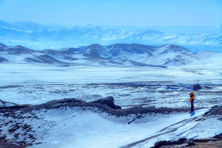
Qinghai Province is located in western China, occupying the northeastern part of the Qinghai–Tibet Plateau. It is China's fourth-largest provincial-level administrative region by land area. Viewed from above, Qinghai's landscape resembles a vast geological masterpiece sculpted by immense tectonic forces. The southern region consists of the majestic Southern Qinghai Plateau, bordering the Tibet Autonomous Region, with an average elevation exceeding 4,200 meters. To the northwest lies the expansive Qaidam Basin, enclosed by the Altun Mountains, the Qilian Mountains, and the Kunlun Mountains. In the east stretches the comparatively gentle Hehuang Valley, a narrow corridor situated between the Qilian and Laji Mountains. Although this valley accounts for less than 5% of the province's total area, it is home to nearly two-thirds of Qinghai's population.
Qinghai is the birthplace of three of China's greatest rivers—the Yangtze River, the Yellow River, and the Lancang River (known internationally as the Mekong River)—earning it the title of "China's Water Tower." The Yellow River meanders for nearly 1,700 kilometers within the province, beginning as a small stream in the Yueguzonglie Basin before growing into a mighty river with rolling muddy waves by the time it leaves Qinghai.
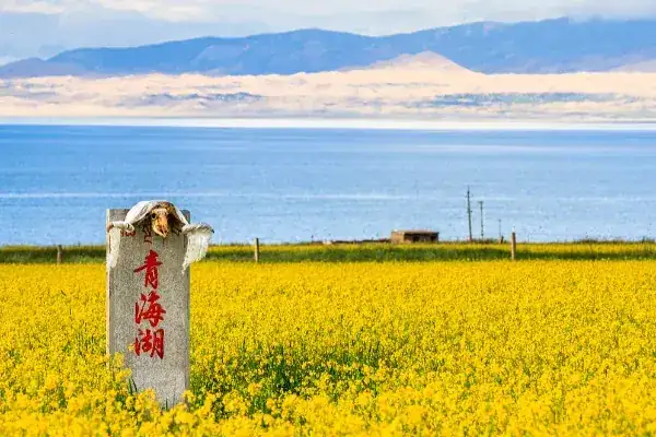
Qinghai Lake, located in the northeastern part of the province, is China's largest inland saltwater lake. Sitting at an elevation of 3,196 meters above sea level, it covers approximately 4,549 square kilometers (2022 data), appearing like an enormous sapphire set amid the alpine grasslands of the plateau.
Qinghai covers a total area of approximately 722,300 square kilometers, stretching roughly 1,200 kilometers from east to west and 800 kilometers from north to south. According to China's Seventh National Population Census in 2020, the province has a permanent population of approximately 5.924 million, making it the second least populated provincial-level region in China after Tibet, with an average population density of fewer than nine people per square kilometer.
Administratively, Qinghai consists of two prefecture-level cities—Xining and Haidong—and six autonomous prefectures: Haibei Tibetan Autonomous Prefecture, Hainan Tibetan Autonomous Prefecture, Haixi Mongolian and Tibetan Autonomous Prefecture, Huangnan Tibetan Autonomous Prefecture, Golog Tibetan Autonomous Prefecture, and Yushu Tibetan Autonomous Prefecture.
The provincial capital, Xining, lies within the Hehuang Valley in eastern Qinghai and serves as the political, economic, and cultural center of the northeastern Qinghai–Tibet Plateau. It is also the province's only city with a population exceeding one million.
Haidong, positioned as Qinghai's eastern gateway, functions as an important bridge connecting the province with neighboring Gansu Province and central China. Golmud, administered by Haixi Prefecture, is the principal city of the Qaidam Basin and a strategic transportation hub linking Tibet and Xinjiang. Both the Qinghai–Tibet Railway and the Qinghai–Tibet Highway converge here before continuing southward.
Yushu City, located on the Southern Qinghai Plateau, is an important center of Tibetan culture. It gained widespread recognition following its reconstruction after the devastating 2010 Yushu earthquake and today forms one of the core areas of Sanjiangyuan National Park.
Qinghai is often referred to as "The Source of Rivers," a name that reflects its unique role as the headwaters of several major Asian rivers. Another common designation, "The Eastern Roof of the World," highlights its defining geographical identity. As an integral part of the Qinghai–Tibet Plateau, the province has an average elevation of over 3,000 meters, making it an indispensable chapter in understanding the geography of western China.
---
Historical Development
Human activity in Qinghai can be traced back tens of thousands of years to the Paleolithic Age. Around 4,000 years ago, the Hehuang Valley became home to a flourishing painted pottery culture, forming one of the core regions of the Majiayao Culture in the upper Yellow River basin.
During the Bronze Age, approximately 3,500 to 2,600 years ago, eastern Qinghai witnessed the emergence of the distinctive Kayue Culture, widely regarded as archaeological evidence of the early Qiang people. The Qiang, recorded as the earliest known inhabitants of Qinghai in Chinese historical texts, established numerous tribal communities across the plateau, where pastoralism formed the foundation of their way of life.
The Han Dynasty: Qinghai Enters Recorded Chinese History
The Han dynasty marked Qinghai's formal entry into China's historical record.
In 121 BCE, the Han cavalry general Huo Qubing defeated the Xiongnu and established Xiping Pavilion near present-day Xining, marking the beginning of effective central government administration over the Hehuang region.
During the reign of Emperor Wu of Han, the office of Protector of the Qiang was established to oversee relations with the Qiang tribes. In 4 CE, Wang Mang created Xihai Commandery in present-day Haiyan County, officially incorporating Qinghai Lake into the administrative framework of the central government.
During the Eastern Han dynasty, the establishment of Xiping Commandery transformed the Hehuang region into an important transportation corridor connecting central China with the Western Regions.
One of the most significant archaeological remains from this era is the ancient city site of Xihai Commandery in Haiyan County, where the surviving rammed-earth walls still testify to the city's former scale.
The Tuyuhun Kingdom and the Silk Road
Between the fourth and sixth centuries, during the Wei, Jin, and Northern and Southern Dynasties, Qinghai became a crossroads of competing ethnic groups.
The Tuyuhun, a branch of the Xianbei people originally from Liaodong, migrated westward and established the Kingdom of Tuyuhun (313–663), centered around Qinghai Lake. Lasting for more than 350 years, this powerful steppe kingdom controlled the trade routes linking central China, the Western Regions, and Tibet.
Known as the Tuyuhun Road or the Qinghai Route, these routes formed an important branch of the Silk Road.
The Tuyuhun economy was based primarily on pastoralism, with horse breeding occupying a particularly prominent position. The famous Qinghai Cong horses were highly prized by successive Chinese dynasties as superior military mounts.
The ancient tombs in today's Dulan County have yielded large quantities of silk, gold, silver, and other precious artifacts, providing compelling evidence of the flourishing East–West trade that once passed through Qinghai.
The Tibetan Empire and the Tang–Tibet Ancient Road
In the mid-seventh century, the expanding Tibetan Empire conquered the Kingdom of Tuyuhun in 663, bringing most of Qinghai under Tibetan rule.
Over the following two centuries, large numbers of Tibetans migrated into the region, gradually integrating with the indigenous Qiang people and the descendants of the Tuyuhun. Together they formed the foundation of today's Tibetan population in Qinghai.
The Tang–Tibet Ancient Road became the principal route linking Chang'an with Lhasa. The cities of Shanzhou (modern-day Ledu) and Shancheng (modern-day Xining) served as vital stops along this route.
Both Princess Wencheng and Princess Jincheng traveled to Tibet via this road, leaving behind numerous legends and historical sites, including the Princess Wencheng Temple in Yushu.
Following the collapse of the Tibetan Empire in the mid-ninth century, Qinghai entered a prolonged period of political fragmentation dominated by competing tribal powers.
Song, Yuan, Ming, and Qing Dynasties
In the early eleventh century, descendants of the Tibetan royal family established the Gusiluo Kingdom (c. 1008–1104), centered in present-day Xining.
Allied with the Song dynasty against the Western Xia, the kingdom made eastern Qinghai a frontier contested by the two powers. In 1104, Song forces captured Shanzhou, although the Jin dynasty soon replaced the Song as the dominant power in northwestern China.
During the thirteenth century, the rise of the Mongol Empire brought Qinghai under Mongol control following Genghis Khan's conquest of the Western Xia.
Under the Ming dynasty, the central government implemented the Wei-Suo military garrison system. Xining Guard became a major frontier stronghold, while the tea-horse trade flourished, attracting large numbers of Hui merchants who settled permanently in the Hehuang Valley.
In the late sixteenth century, construction began on Kumbum Monastery, the birthplace of Tsongkhapa, founder of the Gelug school of Tibetan Buddhism. It gradually developed into the foremost religious center of the Amdo region.
After Altan Khan, leader of the Tümed Mongols, established influence around Qinghai Lake and formed an alliance with the Gelug school, Mongolian and Tibetan communities in Qinghai experienced centuries of both conflict and cultural integration, shaping the province's distinctive multiethnic landscape.
Modern Qinghai
During the Qing dynasty, following Emperor Yongzheng's suppression of the rebellion led by the Mongol prince Lobzang Danjin in 1724, Xining Guard was reorganized into Xining Prefecture, and the Office of the Imperial Resident in Xining was established to administer Mongolian and Tibetan affairs directly.
This administrative system remained in place for more than a century, implementing separate governance for Mongolian and Tibetan communities while respecting their respective customs and traditions.
In 1929, during the Republic of China, Qinghai was formally established as a province, with Xining designated as its capital. The city subsequently entered a period of modernization.
Following the founding of the People's Republic of China, the People's Government of Qinghai Province was established in 1950. Development of the Qaidam Basin soon became a national priority, and builders from across China transformed the once-desolate Gobi Desert into new industrial cities such as Golmud and Delingha.
Today, Qinghai's rich historical legacy remains clearly visible. From Han dynasty beacon towers and ancient Tuyuhun tombs to the hoofprints preserved along the Tang–Tibet Ancient Road and the gilded roofs and white stupas of Kumbum Monastery, every monument tells the story of a civilization that has evolved across millennia on this extraordinary high plateau.
Cultural Heritage
Qinghai's cultural landscape is the product of centuries of coexistence among diverse ethnic groups. Dominated by the Tibetan, Hui, Tu, Salar, and Mongolian peoples, the province has developed a cultural identity distinguished by its unique highland character. Here, nomadic and agricultural civilizations flourish side by side, while Tibetan Buddhism and Islam coexist in close proximity. Over thousands of years of interaction, different languages, styles of dress, customs, and traditions have preserved their individual identities while continually influencing and enriching one another.
Language offers perhaps the most direct reflection of Qinghai's cultural diversity. The province's linguistic landscape is broadly divided into two major systems. The first is the Qinghai dialect of Mandarin, also known simply as Qinghaihua, which is spoken primarily in the Hehuang Valley by approximately three million people. Qinghaihua preserves numerous features of Classical Chinese vocabulary and grammar while incorporating a substantial number of loanwords from Tibetan and Mongolian, resulting in a distinctive hybrid dialect.
The second major linguistic system is Amdo Tibetan, spoken mainly across the Southern Qinghai Plateau and the vast pastoral regions of Haibei and Haixi. With approximately 1.5 million speakers, Qinghai represents one of the principal heartlands of the Amdo dialect, which retains many characteristics of ancient Tibetan.
In addition, the Tu language (belonging to the Mongolic branch of the Altaic language family), the Salar language (belonging to the Turkic branch), and Mongolian continue to be spoken within their respective ethnic communities.
In the Hehuang region, speakers of Chinese, Tibetan, and Tu languages often share enough vocabulary for basic everyday communication. This remarkable linguistic blending is commonly described by the local expression "wind stirring snow", a vivid metaphor for the natural mixing of languages and cultures.
Folk Traditions and Festivals
Qinghai's traditional festivals are deeply influenced by religious beliefs and the rhythms of the seasons.
The Great Prayer Festival held during the first month of the Tibetan calendar is the most important annual celebration for Tibetan Buddhist monasteries. Among its highlights is the famous Butter Sculpture Exhibition at Kumbum Monastery on the fifteenth day of the first lunar month. During the harsh winter, artisans painstakingly sculpt intricate figures from colored butter, depicting Buddhist stories, historical figures, flowers, birds, and auspicious animals. Renowned for their extraordinary craftsmanship and brilliant colors, these sculptures are celebrated throughout the Tibetan world.
Another major cultural event is the June Festival, a traditional folk ritual unique to the Regong region centered around Tongren City. Villages take turns hosting ceremonies throughout the latter half of the sixth month of the Tibetan calendar, with festivities lasting more than ten days. Rituals include sacred masked dances, dragon-drum performances, and ceremonial body-piercing practices. In 2009, these traditions were inscribed on UNESCO's Representative List of the Intangible Cultural Heritage of Humanity.
For Qinghai's Muslim communities, Eid al-Fitr and Eid al-Adha are marked by cascade congregational prayers at Dongguan Grand Mosque in Xining, where tens of thousands of worshippers gather in a magnificent display of religious devotion.
The Nadun Festival of the Tu people is often referred to as "the world's longest carnival." Lasting from the twelfth day of the seventh lunar month until the fifteenth day of the ninth month, each village celebrates in succession with Buddhist chanting, the Zhuangjiaqi dance, and traditional Nuo opera performances. The festival represents a living fossil of ancient shamanistic beliefs and agricultural rituals.
Artistic Traditions
Among Qinghai's most celebrated cultural treasures is Regong Art.
The word Regong, meaning "Golden Valley Where Dreams Come True" in Tibetan, refers to the area centered around Tongren City, long regarded as the artistic heart of the Amdo Tibetan region.
Regong Art encompasses four principal forms: Thangka painting, wall murals, appliqué embroidery, and sculpture. With a history spanning several centuries, it combines artistic influences from India, Nepal, and traditional Chinese Buddhist art, producing works characterized by vibrant colors and exceptionally refined linework.
Regong has been officially recognized by the China Folk Literature and Art Association as the "Hometown of Chinese Thangka Art." In 2009, Regong Arts were inscribed on UNESCO's Representative List of the Intangible Cultural Heritage of Humanity.
In this region, painting Thangkas is a remarkably widespread skill among men, and many accomplished artists have established studios not only in Lhasa and Chengdu but also overseas.
Another distinctive artistic tradition is Qinghai Hua'er, a form of folk singing that flourishes throughout the Hehuang Valley. Also known as "Shaonian", these songs are performed in Chinese with soaring melodies and are often improvised. Traditionally sung antiphonally in fields or during dedicated Hua'er festivals, they represent a shared cultural heritage embraced by Han, Hui, Tu, Salar, Tibetan, and other ethnic communities.
In 2009, Gansu Hua'er, which includes the Qinghai tradition, was likewise inscribed on UNESCO's Representative List of the Intangible Cultural Heritage of Humanity.
Intangible Cultural Heritage
Qinghai possesses one of China's richest collections of intangible cultural heritage.
As of 2023, the province had 236 officially recognized representative intangible cultural heritage projects, including 73 national-level items. Among the most significant are the Tibetan heroic epic King Gesar, Tu embroidery (Pansiu), and the Huangyuan Row Lantern Festival.
The Epic of King Gesar is widely regarded as the world's longest living epic tradition. Across the Tibetan regions of Qinghai, master storytellers known as Zhongken are capable of reciting hundreds of thousands of lines entirely from memory, recounting the legendary exploits of King Gesar as he defeats demons and unites rival tribes.
In 2009, the Epic of Gesar was inscribed on UNESCO's Representative List of the Intangible Cultural Heritage of Humanity.
---
Architecture and Urban Landscape
Qinghai's architectural landscape is a three-dimensional tapestry shaped by geography, ethnic traditions, and religious beliefs. From rammed-earth courtyard compounds in the Hehuang Valley to black yak-hair tents on the grasslands, from the golden roofs and white walls of Tibetan Buddhist monasteries to the modern industrial architecture of cities rising from the Gobi Desert, the province presents a visually striking narrative of place and culture.
Traditional Architecture
The most representative traditional residence in Qinghai is the Zhuangkou Courtyard found throughout the Hehuang Valley.
This quadrangle-style dwelling is enclosed by massive rammed-earth walls standing 4–5 meters high and approximately one meter thick, with tops capped with adobe bricks providing protection from both fierce winds and bitter winters. Resembling miniature fortresses, these compounds are typically oriented southward, with the main house located on the northern side and subsidiary buildings positioned along the eastern and western wings. Fruit trees and flowering plants are commonly cultivated within the courtyard.
Every construction material is sourced locally—including loess, timber, and wheat straw. The warm yellow earthen walls blend seamlessly into the surrounding loess hills, creating remarkable harmony between architecture and landscape.
Across the pastoral regions of the Southern Qinghai Plateau, traditional Tibetan homes take the form of stone watchtower houses. Usually two stories in height, the ground floor shelters livestock while the upper level serves as living quarters. Thick stone walls and small windows provide effective insulation against the harsh alpine climate.
The black yak-hair tent represents the oldest form of nomadic Tibetan dwelling. Built around a wooden frame and covered with woven black yak-hair fabric, these square tents offer warmth during winter, protection from rain in summer, and can be dismantled and transported with ease.
Tibetan Buddhist Monasteries
Tibetan Buddhist monasteries constitute the most recognizable architectural landmarks in Qinghai.
Kumbum Monastery, located in Huangzhong District, was founded in 1560 during the Ming dynasty. It is the birthplace of Tsongkhapa, founder of the Gelug school of Tibetan Buddhism, and ranks among the Six Great Monasteries of the Gelug tradition.
Covering more than 600 mu (approximately 40 hectares), the monastery ascends a hillside with an elevation difference of about 80 meters between its entrance gate and the magnificent Great Golden Roof Hall.
Kumbum is a masterpiece of Han-Tibetan architectural integration. The Great Golden Roof Hall features a traditional Chinese double-eaved hip-and-gable roof clad in gilded bronze tiles—a gift bestowed by Emperor Qianlong that reportedly required 1,300 taels of gold. Inside, however, the layout follows classical Tibetan monastic design, enshrining the sacred white sandalwood tree believed to have grown at Tsongkhapa's birthplace, together with a magnificent silver reliquary stupa.
Buildings such as the Lesser Golden Roof Hall, the Great Prayer Hall, and the Maitreya Hall cascade across the mountainside. Their white walls and golden roofs shine brilliantly beneath the intense highland sunlight.
Within the Great Prayer Hall, 108 intricately carved wooden columns support a vast interior capable of accommodating more than 2,000 monks chanting simultaneously. Hanging appliqué Thangkas and colorful prayer banners create an atmosphere of profound spiritual devotion.
One of the monastery's most iconic landmarks is the Eight Auspicious Stupas, a row of eight white stupas symbolizing the eight great deeds in the life of the Buddha.
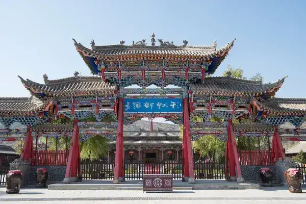
Another architectural treasure is Qutan Monastery in Ledu District, often called "the Little Forbidden City." Founded in 1392 during the Hongwu reign of the Ming dynasty, the monastery's overall layout closely resembles Beijing's Forbidden City. Along its central axis stand the Mountain Gate, Vajra Hall, Qutan Hall, Baoguang Hall, and Longguo Hall, while covered corridors flank both sides. Its exquisitely painted timber structures represent one of the finest surviving examples of official Ming dynasty architecture in China's frontier regions.
Urban Landscape
The provincial capital, Xining, displays the classic characteristics of a valley city.
Its urban area stretches east to west along the Huangshui River Valley, constrained by mountains on both the northern and southern sides, creating a distinctive ribbon-like urban form often described as "one river between two mountains."
The old city developed from the Ming dynasty fortress of Xining Guard. Although the ancient city walls have disappeared, the historic grid pattern centered on Dongguan, Dashizi, and Ximen remains clearly visible.
Dongguan Grand Mosque, originally constructed during the Hongwu reign of the Ming dynasty, is Qinghai's largest and oldest mosque. Designed in the traditional Chinese palace style, it can accommodate approximately 4,000 worshippers simultaneously. The surrounding Hui neighborhoods have developed into a classic Islamic community centered around the mosque.
Until the early twenty-first century, Xining's skyline consisted largely of buildings fewer than six stories tall. Over the past two decades, however, limited land within the narrow river valley has driven the rapid construction of high-rise buildings, dramatically transforming the city's appearance.
Golmud, by contrast, is a city born from the Gobi Desert. Established in 1954 following the completion of the Qinghai–Tibet Highway, its urban plan follows the highway's main axis. Functional, practical architecture dominates the cityscape, while broad avenues lined with shelterbelts remain the defining visual characteristic of this remarkably young desert city.
Culinary Culture
Qinghai's cuisine is the product of high-altitude survival wisdom blended with the culinary traditions of multiple ethnic groups. With an average elevation exceeding 3,000 meters, the province's agricultural output centers on cold- and drought-resistant crops such as highland barley, wheat, and potatoes, while its pastoral regions depend primarily on yaks and Tibetan sheep. The harsh natural environment has shaped a cuisine that emphasizes high-calorie, long-lasting, and filling foods. At the same time, Qinghai's multicultural population has given its dining traditions remarkable depth and diversity.
Qinghai cuisine is a distinctive branch of Northwestern Chinese cuisine, characterized by what can best be described as "simplicity with substance." Its simplicity lies in straightforward cooking techniques—mainly boiling, stewing, and roasting—that highlight the natural flavors of the ingredients. Its substance comes from bold, hearty flavors: dishes tend to be salty and rich, feature generous amounts of beef and mutton, employ aromatic spices to remove gaminess, and place particular emphasis on substantial wheat-based staples. Tibetan cuisine revolves around tsampa (roasted barley flour), yak meat, and butter tea, reflecting the demands of a nomadic lifestyle. Hui and Salar cuisine strictly follows Islamic dietary laws and is especially renowned for its mastery of noodles and halal beef and lamb dishes. Han Chinese cuisine incorporates elements from both traditions while retaining features of the Central Plains culinary heritage. These three culinary traditions converge in cities such as Xining and Haidong, giving rise to the distinctive Hehuang food culture.
Among Qinghai's many specialties, four dishes stand out as iconic.
First is Qinghai traditional yogurt (Lao Suannai). This beloved local delicacy is naturally fermented from fresh yak's milk or cow's milk without the use of gelatin or artificial thickeners. It has a silky texture resembling soft tofu and develops a delicate pale yellow cream layer on the surface. Unlike commercially sweetened yogurts, Qinghai yogurt is typically enjoyed plain and unsweetened, offering a pleasantly tart flavor balanced by natural sweetness and an exceptionally rich dairy aroma. In Xining's Mojia Street and Shuijing Alley, freshly made yogurt is sold everywhere in small bowls.
Second is hand-pulled boiled mutton (Shouzhua Yangrou). This is the quintessential ceremonial dish shared by all ethnic groups in Qinghai when entertaining guests. Premium Qinghai Tibetan sheep—usually ribs or leg cuts—are simmered in plain water with only salt and a small amount of Sichuan peppercorns. The meat is then torn apart by hand and eaten while still hot. Excellent hand-pulled mutton is remarkably tender with almost no gamey flavor. It is commonly dipped in garlic paste and seasoned salt, then accompanied by a steaming bowl of mutton broth, locally known as tian tang ("refill soup"). Tibetan sheep raised on alpine pastures above 3,000 meters feed on medicinal herbs, producing meat of exceptional quality, with sheep from Qilian County in Haibei Prefecture and Guinan County in Hainan Prefecture regarded as among the finest.
Third is Rangpi (steamed wheat starch sheets). This is the most common street snack throughout the Hehuang region. Wheat flour is washed to separate gluten from starch. The starch slurry is steamed into thin sheets, sliced into strips, and tossed with chili oil, vinegar, garlic sauce, mustard, and chopped Chinese chives. The result is cool, chewy, and refreshing. Compared with Shaanxi's liangpi, Qinghai's version is thicker, chewier, and dressed with a more intensely sour and spicy seasoning. Rangpi stalls can be found on virtually every street in Xining, making it one of the city's most affordable and authentic everyday foods.
Fourth is "Dog Pee Pancake" (Gou Jiao Niao). Despite its unusual name, this is a traditional pan-fried flatbread. The name comes from the cooking process: hot rapeseed oil is poured from a narrow-spouted kettle around the edge of the pan, where it trickles down the sides in a way said to resemble a dog urinating. Made from scalded dough, the pancake develops a crisp, fragrant crust while remaining soft and pleasantly chewy inside. It is commonly eaten with white sugar or served alongside milk tea, and remains especially popular among both Tu and Han communities.
Qinghai's dining customs reflect the character of its people. Guests visiting Tibetan pastoral households are invariably welcomed with butter tea and hand-pulled mutton. When eating meat, diners are expected to enjoy generous bites rather than nibbling slowly, as hearty eating is considered a sign of appreciation for the host's generosity. Hui families traditionally serve Eight-Treasure Gaiwan Tea, brewed with tea leaves, longan, red dates, goji berries, rock sugar, and other ingredients. Proper etiquette requires holding the saucer with the left hand while gently lifting the lid with the right, partially covering the cup after each sip to demonstrate refinement and restraint. The people of Qinghai embody both the openness of nomadic cultures and the thrift of farming communities. Their love of feasting on large portions of meat and sharing drinks sits comfortably alongside a deep respect for every grain of highland barley. On the Qinghai Plateau, where survival has never been easy, both generosity and frugality represent profound adaptations to the environment.
Modern Development
Qinghai's modern transformation is fundamentally the story of a remote frontier evolving into one of China's most important resource-development bases. Beginning in the mid-20th century, this transformation propelled a province with almost no modern industry onto the path of industrialization and urbanization within just seven or eight decades, profoundly reshaping both its population distribution and economic landscape.
The first chapter of Qinghai's modernization unfolded in the Qaidam Basin. On December 25, 1954, the Qinghai–Tibet Highway officially opened, connecting Xining and Lhasa with a 2,100-kilometer road across the "Roof of the World." Under the leadership of General Mu Shengzhong, road builders completed this extraordinary feat in just seven months and four days. The first tent pitched beside the Golmud River marked the birth of the city of Golmud. In 1955, geological surveys discovered the Lenghu Oilfield, followed by large-scale development of the Mangya asbestos mine, the Xitieshan lead-zinc mine, and the vast potash deposits of Qarhan Salt Lake. What had once been described as "800 li of uninhabited wilderness" gradually became Qinghai's industrial heartland. During this period, thousands of builders from Northeast China, Shanghai, Henan, and elsewhere migrated to the region, giving rise to new cities such as Golmud, Delingha, and Dachaidan.
The construction of the Qinghai–Tibet Railway marked the second major stage of modernization. Work on the Xining–Golmud section (834 kilometers) began in 1958, but technological limitations and shifting national priorities delayed completion for nearly a quarter of a century before the line officially opened in 1984. Passing Qinghai Lake, Guanjiao Mountain, and Qarhan Salt Lake, the railway dramatically lowered transportation costs for the Qaidam Basin's mineral resources. On July 1, 2006, the Golmud–Lhasa section (1,142 kilometers) entered service, significantly strengthening Qinghai's strategic role as China's primary transportation gateway to Tibet. Xining consequently became both the starting point of the Qinghai–Tibet Railway and the principal transfer hub for travelers heading to the Tibetan Plateau.
Alongside heavy industry came the large-scale development of the upper Yellow River's hydropower resources. The Longyangxia Hydropower Station (1.28 million kilowatts; first generating unit commissioned in 1987) and the Lijiaxia Hydropower Station (2 million kilowatts; operational in 1997) transformed the upper Yellow River into western China's largest hydropower base. The abundant supply of inexpensive electricity attracted energy-intensive industries such as aluminum smelting. Large industrial clusters emerged around Qinghai Qiaotou Aluminum & Power in Datong County near Xining and the electrolytic aluminum industry in Minhe County. Hydropower remains one of Qinghai's cornerstone industries, and installed generating capacity along the upper Yellow River continues to expand.
Since China's Reform and Opening-up, especially in the 21st century, Qinghai's industrial landscape has evolved through the coexistence of traditional resource industries and emerging green sectors. On the traditional side, the Qaidam Circular Economy Pilot Zone became one of China's first national circular economy demonstration areas in 2005. Leveraging the abundant potassium, sodium, magnesium, and lithium resources of Qarhan Salt Lake, it has developed an integrated industrial chain linking salt-lake chemicals, non-ferrous metallurgy, and oil and gas processing. Qinghai Salt Lake Industry Co., Ltd. has become China's largest producer of potash fertilizer.
At the same time, ecological conservation has risen to become Qinghai's foremost strategic priority. The Sanjiangyuan National Nature Reserve was established in 2000, followed by the launch of the Sanjiangyuan National Park pilot program in 2016—the first national park pilot in China—which was officially designated as a national park in 2021. Covering approximately 190,700 square kilometers—more than one-quarter of the province's total area—the park strictly prohibits industrial development and mineral extraction within its protected zones. The ongoing challenge of balancing ecological preservation with economic growth remains one of Qinghai's defining issues.
Qinghai is also pursuing a third path centered on green industries and sustainable development. Large-scale solar and wind power projects in Hainan and Haixi prefectures have become new engines of economic growth. The Talatan Photovoltaic Industrial Park, with an installed capacity exceeding 10 million kilowatts, is the world's largest photovoltaic power generation complex. Meanwhile, Xining is striving to establish itself as the modern service center of the northeastern Tibetan Plateau through the development of national economic and technological development zones, university districts, and high-speed rail new towns, representing the latest phase of urbanization.
In 2023, Qinghai's gross domestic product reached approximately RMB 375 billion (about USD 52 billion). Although its overall economic output ranks among the lowest of China's provincial-level regions, its GDP per capita remains around the national middle range. Qinghai's central development dilemma is that vast ecological protection zones significantly limit the physical space available for industrial expansion. Yet as the source of water for hundreds of millions of people downstream, the province bears enormous ecological responsibilities whose value cannot be fully measured by GDP statistics alone. Such is the responsibility carried by China's "Water Tower."
Transportation and Travel
Qinghai's transportation network is a backbone system engineered under some of the world's most challenging geographical conditions. Its fundamental mission is to overcome the barriers of the Tibetan Plateau and connect this vast inland region with the outside world. Centered on Xining, the province's transportation system radiates outward in all directions, integrating railways, highways, and aviation into a comprehensive multimodal network.
Railways form the backbone of Qinghai's transportation system. The Qinghai–Tibet Railway is unquestionably its most important route. Departing from Xining, it passes through Huangyuan and Haiyan, skirts the northern shore of Qinghai Lake, crosses Guanjiao Mountain—where the original Guanjiao Tunnel at an elevation of 3,690 meters was once the world's highest railway tunnel, while the 32.6-kilometer New Guanjiao Tunnel, opened in 2014, is currently China's longest railway tunnel—before entering the Qaidam Basin. From there, it continues through Delingha and Golmud, then climbs over the Kunlun Pass and Tanggula Pass into Tibet. In July 2023, upgrades to the Xining–Golmud section enabled Fuxing high-speed EMUs to operate on the Tibetan Plateau for the first time, reducing the fastest travel time between Xining and Golmud to under five and a half hours.
The Lanzhou–Xinjiang High-Speed Railway passes through northeastern Qinghai, serving Ledu South Station in Haidong, though it does not extend to Xining. However, with the completion of the Lanzhou–Zhangye High-Speed Railway, Xining has gained efficient access to China's national high-speed rail network via the Lanzhou hub, reducing travel time between Xining and Lanzhou to approximately one hour and forty minutes. In addition, the Dunhuang–Golmud Railway, which opened in 2019, provides Qinghai with a vital northern connection to the Hexi Corridor of Gansu Province.
The province's expressway network is anchored by several major routes, including the Beijing–Tibet Expressway (G6, with the Xining–Golmud section now open), the Xining–Lijiang Expressway , the Chaka–Delingha Expressway, and the Delingha–Xiaochaidan Expressway. The G6 enters Qinghai from Lanzhou, passes through Xining, follows the northern shore of Qinghai Lake, and continues via Delingha to Golmud, serving as the province's primary transportation corridor. The Xining–Lijiang Expressway heads south through Gonghe, Madoi, and Yushu, roughly following the historic Tang–Tibet Ancient Road at elevations often exceeding 4,000 meters, making it one of the principal routes across southern Qinghai. By 2023, Qinghai had approximately 4,500 kilometers of expressways. However, many sections are upgraded Class II highways rather than full-access expressways, while true multi-lane expressways are concentrated within roughly 100 kilometers of Xining. Reaching remote prefectural capitals such as Golog or Yushu often requires seven to eight hours of driving, with road conditions heavily influenced by seasonal weather.
Qinghai's civil aviation network follows a "one primary hub with multiple regional airports" model. Xining Caojiabao International Airport, located about 28 kilometers east of downtown Xining, serves as the province's principal aviation hub. In 2023, it handled more than eight million passengers (including transit traffic) and offers flights to major Chinese cities such as Beijing, Shanghai, Chengdu, Xi'an, and Lhasa, as well as international charter services to destinations including Hong Kong and Bangkok. It is the largest aviation gateway in the northeastern Tibetan Plateau. Regional airports include Golmud Airport, Yushu Batang Airport, Delingha Airport, Golog Maqin Airport, Huatugou Airport, Qilian Airport, and the under-construction Huangnan Airport. Yushu Batang Airport, at an elevation of 3,905 meters, is China's fourth-highest civilian airport. Although regional airports now serve every prefecture-level jurisdiction, flight frequencies remain limited, winter weather often causes cancellations, and airfares tend to be relatively expensive.
Traveling through Qinghai is itself a memorable experience. On the Qinghai–Tibet Railway, passengers departing Xining witness the landscape gradually transform—from the loess hills of the Huangshui River Valley to the brilliant blue waters of Qinghai Lake, then across the deserts of the Qaidam Basin before climbing into the snow-covered plateau. Train carriages are equipped with supplemental oxygen systems, while specially designed UV-protected windows allow travelers to watch Tibetan antelopes running freely across Hoh Xil.
Driving offers the greatest freedom for exploring Qinghai's vast interior. Along endless grassland highways, it is entirely normal to travel for dozens of kilometers without seeing another person, while the horizon stretches uninterrupted in every direction. International travelers should note, however, that some parts of Qinghai remain subject to access restrictions for foreign visitors, particularly certain counties in Yushu and Golog prefectures, where special permits must be obtained in advance.
Travel Tips
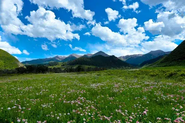
Qinghai is a destination with four distinct seasons, each offering its own unique appeal. If asked when to visit, however, most locals would recommend July through September as the province's golden travel season. During these months, the rapeseed fields surrounding Qinghai Lake burst into full bloom, creating vast carpets of brilliant yellow that stretch from the lakeshore to the foothills, beautifully contrasting with the lake's deep blue waters and the snow-capped mountains beyond. Daytime temperatures typically range between 15°C and 25°C, providing refreshingly cool weather while much of China experiences intense summer heat. This is also the season for major Tibetan festivals, including horse racing events and the Liuyuehui celebrations.
By late September, Qinghai enters a brief autumn. The grasslands turn golden, tourist numbers decline significantly, and prices drop, making it an excellent time for travelers seeking pleasant weather without the crowds. From October through April, the province experiences a long winter, with temperatures occasionally falling below -20°C. Many mountain passes become snowbound, yet Kumbum Monastery (Ta'er Monastery) with pilgrims walking the kora after snowfall, takes on a uniquely tranquil, almost meditative charm during this season, while snow-covered mountains around Golmud and the frozen landscapes of Qarhan Salt Lake reveal the plateau at its most starkly beautiful. May and June are generally windy months, when dust storms occasionally sweep across the Qaidam Basin, making them less favorable for travel.
Among Qinghai's many attractions, Qinghai Lake deserves top priority. Unless you are staying near downtown Xining and have other plans, you should set aside at least a full day to explore the lake. The classic route begins in Xining and follows National Highway 109 along the lake's southern shore via Riyue Mountain and Daotang River to Erlangjian Scenic Area. An even more rewarding experience, however, is to bypass the commercial tourist zone and visit the open lakeshores near Heimahe Township on the western shore or around Bird Island and the nearby sand islands in the north. Here, visitors encounter fewer crowds, while the lake displays stunning gradients from turquoise near the shore to deep sapphire blue farther out, with snow-capped peaks mirrored in its waters. Between May and June, tens of thousands of migratory birds—including bar-headed geese and brown-headed gulls—nest around Bird Island, making it one of China's finest birdwatching destinations. At an elevation of approximately 3,200 meters, visitors arriving from lower altitudes may experience mild symptoms of altitude sickness and should take things slowly while avoiding strenuous exercise.
The second destination not to miss is Kumbum Monastery (Ta'er Monastery), located about 40 minutes by car from downtown Xining. Visitors should allow at least half a day, ideally arriving in the morning and following pilgrims clockwise around the monastery. Admission was RMB 80 in 2023, and some halls—including the Great Golden Roof Hall and the Small Golden Roof Hall—require additional ticket inspection. The true highlights are not merely the impressive buildings but the atmosphere itself: outside the Great Assembly Hall, young monks engage in lively Buddhist debates punctuated by rhythmic handclaps, while the Butter Sculpture Hall showcases extraordinary sculptures painstakingly crafted under near-freezing conditions and renewed annually after the Lantern Festival. Visitors should remove hats before entering temple halls, avoid flash photography when photographing butter sculptures, and always ask permission before photographing monks.
The third must-see experience is Sanjiangyuan and Hoh Xil. It should be noted that the core conservation zones of Sanjiangyuan National Park are not open to ordinary tourists. However, travelers can journey through the Hoh Xil National Nature Reserve via the Qinghai–Tibet Highway (National Highway 109). Starting from Golmud, the route passes Kunlun Pass (4,768 meters), Budongquan, Wudaoliang, and finally Tuotuohe over a distance of approximately 420 kilometers, offering one of Qinghai's most epic road trips. Along the way, travelers may encounter Tibetan antelopes, Tibetan wild asses, and Tibetan gazelles, particularly during the summer months when wildlife often grazes near the highway.
Several practical considerations deserve particular attention. To minimize the effects of altitude sickness, visitors should spend one or two days acclimatizing in Xining (2,261 meters) before traveling to higher-altitude destinations such as Qinghai Lake or Sanjiangyuan. Travelers may wish to consult a physician in their home country about acetazolamide, carry portable oxygen canisters (widely available in Xining pharmacies), and bring ibuprofen for altitude-related headaches. Sun protection is equally essential: ultraviolet radiation on the plateau is significantly stronger than at lower elevations, making SPF 50+ sunscreen, a wide-brimmed hat, and high-quality sunglasses indispensable. Mobile network coverage becomes unreliable outside urban areas, so offline maps should be downloaded in advance. Foreign visitors should also carry their passports and visa copies at all times, and when staying in hotels in places such as Golmud or Yushu, ensure that the required foreign guest registration is completed within 24 hours.
Several important precautions should also be kept in mind. Much of Qinghai consists of environmentally sensitive areas or regions subject to military administration. Foreign nationals require provincial-level authorization to enter the core areas of Sanjiangyuan or the Hoh Xil Nature Reserve, and unauthorized entry may result in penalties. Certain counties—including parts of Zeku County in Huangnan Prefecture and Banma County in Golog Prefecture—remain partially restricted to foreign visitors. Travelers should confirm current regulations with local travel agencies or public security authorities before departure. When interacting with Tibetan, Hui, or other ethnic communities, always ask permission before taking photographs. Dress respectfully when entering mosques or Tibetan Buddhist monasteries, and avoid pointing directly at Buddha statues, elders, or other people with a finger, as this is considered disrespectful across many local cultures.
Qinghai may not be a destination defined by comfort or luxury. Instead, it offers an opportunity to witness nature in one of its most primal forms and to observe how human civilization has adapted to some of the planet's most demanding environments. Its vastness and solitude provide an unforgettable perspective on western China—one that few other places can match.
Travel information can change. Check current opening hours, reservations and entry requirements before you travel.

Traveller discussion
Start the conversation with a helpful tip or a question.