
Hotan Prefecture
Hotan PrefectureHotan Prefecture (Uyghur: خوتەن ۋىلايىتى) is one of the five prefectures of the Xinjiang Uyghur Autonomous Region, with its administrative seat in Hotan City. It borders the Kunlun Mountains and Tibet Autonomous Region to th
Hotan Prefecture
Hotan Prefecture (Uyghur: خوتەن ۋىلايىتى) is one of the five prefectures of the Xinjiang Uyghur Autonomous Region, with its administrative seat in Hotan City. It borders the Kunlun Mountains and Tibet Autonomous Region to the south, the Taklamakan Desert and Aksu to the north, Bayingolin Mongol Autonomous Prefecture to the east, and Kashgar Prefecture to the west. To the southwest, the Karakoram range forms a 210 km boundary with Kashmir. The total area is 248,100 square kilometers. As of February 2026, the prefecture administers one county-level city and nine counties. According to the Seventh National Census (November 1, 2020), the permanent population was 2,504,718. Located at the heart of the Eurasian continent, Hotan has a typical arid continental climate with 36 rivers of varying sizes and is one of China's richest regions for solar energy. The prefecture is renowned for its jade, silk, carpets, and fruits, and is home to 22 ethnic groups, predominantly the Uyghur. In 2025, the prefecture's GDP grew by 6.6% year-on-year.
Name Evolution
Hotan was anciently known as "Yutian," meaning "place of jade production" in Tibetan. Historical texts such as the Book of Tang and Great Tang Records on the Western Regions record various names, including "Kusana" (meaning "earth-milk"), reflecting a local legend about a king nurtured by the earth itself. Since the Yuan dynasty, historical records used variants such as Wudan, Hutan, and Woduan—all phonetic renderings of the same place name across different languages.
Historical Evolution
Pre-Qin Period
Before the Qin and Han dynasties, ancient peoples including Indo-European and Sino-Tibetan speakers, the Saka, Qiang, and Yuezhi inhabited the region.
Qin-Han to Northern and Southern Dynasties
After Zhang Qian's mission to the Western Regions, Hotan was first recorded in Chinese historical texts. In 60 BCE, the Western Han dynasty established the Protectorate of the Western Regions, bringing the oasis states of Pishan, Yutian, Yumi, Qule, Jingjue, and Ronglu under its jurisdiction, formally incorporating Hotan into Chinese territory. By the Wei-Jin period, Yutian had annexed its neighboring city-states, its territory roughly corresponding to present-day Hotan Prefecture.
Sui-Tang to Song-Yuan Periods
In 675 CE, the Tang dynasty established the Pisha Area Command with ten prefectures. During the Five Dynasties period, Li Shengtian was enthroned as king of the Great Treasure Yutian Kingdom. Under the Yuan dynasty (1279–1289), a Pacification Commission was established, placing the region under direct central Yuan administration.
Ming-Qing Period
During the Qing dynasty, the name evolved from "Yutian" to "Hetian." In 1759, the Qing court established the Hetian Affairs Office. After Yaqub Beg's occupation (1865), Qing forces under Liu Jintang recovered Hetian in 1878. In 1883, Hetian became a directly governed prefecture. In 1902, Pishan and Lop counties were established.
Republic of China Period
In 1913, Hetian became a county, with successive administrative reorganizations through the Republican era. In 1933, Muhammad Imin declared a short-lived "Hetian Islamic Republic," which was quickly suppressed. Niya County was established in 1947.
People's Republic of China
Hotan was liberated on December 22, 1949. The prefecture was formally established in 1971. In 1983, Hotan City was created as a county-level city. In December 2024, two new counties—He'an County and Hekang County—were established under Hotan Prefecture's jurisdiction.
Administrative Divisions
As of February 2026, Hotan Prefecture comprises one county-level city—Hotan City—and nine counties: Hotan County, Moyu (Karakash) County, Pishan County, Lop County, Qira County, Keriya County, Niya County, He'an County, and Hekang County, totaling 93 townships and 5 sub-districts.
Geography
Location
Hotan Prefecture lies in the southwestern corner of Xinjiang, centered at 79.92°E, 37.12°N. It stretches approximately 670 km east-west and 600 km north-south, covering 248,100 km². The Kunlun Mountains rise to the south, the Taklamakan Desert extends to the north, and the Karakoram range forms the southwestern border with Kashmir.
Geology
The region's geological structure spans three tectonic plates: the Tarim Plate to the north, the Qiangtang Block to the south, and the Gangdise Plate to the southwest. Strata range from Archean to Cenozoic. Hotan jade forms where magnesian marble contacts intermediate-acidic intrusive rocks of Variscan age along the main Kunlun ridge.
Topography
The terrain descends from south to north in three tiers: high plateau, alpine mountains, and basin. Kunlun peaks generally reach 6,000 m, with the highest exceeding 7,000 m. Seven distinct geomorphic zones range from the highest mountain belt (above 5,200 m, with modern glaciers) through alpine, subalpine, mid-mountain, and low-mountain belts, down to the piedmont alluvial plain (1,250–2,200 m) and the desert zone (below 1,250 m) at the edge of the Taklamakan.
Climate
Hotan has an extreme arid desert climate in the Eurasian hinterland, shielded by the Pamir Plateau and Tianshan to the west and north, and by the Kunlun and Karakoram ranges to the south, which block moist Indian Ocean currents. Annual precipitation averages just 35 mm, while evaporation reaches 2,480 mm. The region experiences over 220 days of dust weather annually, including about 60 days of severe dust storms. Average annual temperature ranges from 11.0°C to 12.1°C in the oasis plains. Three climatic sub-regions exist: southern mountains, oasis plains, and northern desert.
Hydrology
The prefecture has 36 rivers, including the Yurungkash River, Karakash River, Keriya River, Niya River, Qira River, and Pishan River, with a total annual runoff of 7.4 billion cubic meters. Rivers are highly seasonal—summer accounts for 75% of annual runoff, while spring contributes only 9.6%, creating a pattern of spring drought, summer floods, autumn scarcity, and winter depletion. Most rivers are inland; the Chip Chap River flows into India with an annual outflow of 293 million cubic meters.
Natural Disasters
Major hazards include severe winds, dry hot winds, floods, droughts, and frost. Winds exceeding 17 m/s trigger dust storms. In September 2016, flooding and mudslides across six counties affected 35,000 people, destroyed nearly 400 homes, and devastated 2,200 hectares of farmland, with direct economic losses exceeding 32 million yuan (approximately 4.4 million USD).
Natural Resources
Water Resources
Total water resources amount to 9.741 billion m³, with a utilisable volume of 5.895 billion m³. Major infrastructure includes 50 reservoirs (total capacity: 871 million m³), 27 large and medium diversion headworks, and over 33,000 km of irrigation channels. Notable projects include the Wuluwati Water Control Project (dam height: 133 m, the tallest of its kind in China; total capacity: 347 million m³; installed capacity: 60 MW) and the Yurungkash Water Control Project (planned regulatable capacity: 540 million m³, irrigating 1.6 million mu of farmland in southern Xinjiang). Cumulative water conservancy investment reached 22.517 billion yuan (approximately 3.1 billion USD).
Land Resources
The prefecture covers 247,400 km², including 3.32 million mu (approximately 2,213 km²) of arable land and 64.09 million mu (approximately 42,727 km²) of grassland. Wetlands cover 408,500 hectares (10.35% of Xinjiang's total, ranking third in the region). Forest area totals 15.18 million mu, including 11.01 million mu of natural forest.
Solar and Thermal Resources
Hotan ranks first in Xinjiang for solar energy resources. Annual total radiation in the plains reaches 138.1–151.5 kcal/cm², second only to the Qinghai-Tibet Plateau. Annual sunshine hours total 2,470–3,000. The frost-free period extends 182–226 days in the plains.
Mineral Resources
The prefecture contains 61 mineral types, including Hotan jade, coal, natural gas, petroleum, iron, copper, gold, antimony, lithium, and rare metals. There are 338 mines in operation. Hotan jade remains the signature resource, with inferred reserves of 33,000 tons.
Biological Resources
The region hosts 445 species of wild seed plants across 55 families, with grasses (Poaceae) being the largest family. Approximately 300 bird species have been recorded, including black storks, whooper swans, golden eagles, and white-tailed sea eagles. Four national-level wetland parks have been established: Niya, Lalikun, Keriya River, and Qira Damagou.
Population
As of November 1, 2020, the permanent population was 2,504,718. The prefecture is predominantly Uyghur, with 22 ethnic groups including Han, Hui, Kazakh, and Kyrgyz.
The ancient Khotanese language (5th–10th centuries CE), derived from Indian Brahmi script, was gradually replaced by Old Uyghur after the fall of the Khotan kingdom to the Karakhanid dynasty in 1006. The Hotan dialect remains the second-largest dialect of the Uyghur language, containing numerous loanwords from the Chagatai period.
Religion
Hotan has historically been home to Manichaeism, Nestorian Christianity, Zoroastrianism, Taoism, Buddhism, and Islam. Buddhism arrived in the 1st century BCE and was adopted as the state religion of the Yutian Kingdom, reaching its zenith during the Wei-Jin period. Islam was introduced in the 9th century and became dominant after the Karakhanid conquest of Yutian in 1006.
Economy
Overview
In 2025, Hotan's GDP grew by 6.6% year-on-year. Primary industry grew 5.7%, secondary industry 17.2%, and tertiary industry 4.2%. Fixed asset investment grew 9.9%, with private investment surging 20.5%. General public budget revenue increased 12.0%, and the fiscal self-sufficiency rate rose from 12.38% to 14.07%.
Primary Industry
Total agricultural, forestry, animal husbandry, and fishery output grew 5.9%. The prefecture produced 5,500 tons of pork, 29,400 tons of beef, 66,300 tons of mutton, and 22,000 tons of poultry meat. Sheep stock reached 3.99 million head. Specialty fruit and nut output grew 6.1%.
Secondary Industry
Total industrial value-added grew 54.0%, with above-scale industry surging 63.2%. Mining led with 124.6% growth, followed by utilities (+46.4%) and manufacturing (+23.3%). Construction value-added grew 1.4%.
Tertiary Industry
The service sector grew 4.2%. Retail sales of consumer goods increased 4.4%, with notable gains in clothing (+102.9%), communications equipment (+101.6%), and daily necessities (+80.1%). Financial institution deposits grew 18.7% and loans 22.5%. Eight insurance institutions saw premium revenue rise 10.8%.
Economic Zones
Key industrial parks include the Beijing-Hotan Industrial Park (planned area: 15.5 km²), Qira County Tianjin Industrial Park (4.9 km² developed, 29 enterprises, cumulative investment exceeding 1.02 billion yuan / approximately 140 million USD), and Keriya County Industrial Park. During the 14th Five-Year Plan period, seven priority industries were promoted: agricultural deep processing, footwear and hosiery, textile and apparel, wig products, electronics assembly, cultural tourism, and commerce/logistics.
Social Affairs
In 2025, the prefecture had 1,492 schools, 2,307 medical institutions, 9 performing arts troupes, 5 museums, 9 libraries (total collection: 900,065 volumes), and 14 sports venues. The Hotan Daily published 16.17 million copies across 494 issues. Science and technology efforts included 155 approved projects, 29 newly certified high-tech enterprises, and 103 tech-oriented small and medium enterprises. Social insurance participation grew 1.3%, covering basic pension, medical, unemployment, and work injury insurance.
Transportation
Highways
Total highway mileage reached 24,858 km. Road passenger transport served 15.27 million trips (+83.3% YoY), and freight transport moved 28.04 million tons (−6.0% YoY).
Railways
The Kashgar-Hotan Railway opened on December 30, 2010. The Hotan-Ruoqiang Railway opened on June 26, 2022, completing a railway loop around the Taklamakan Desert. Railway passenger transport served 1.736 million trips, and freight moved 324,000 tons.
Aviation
Hotan Kungang Airport, located 12 km south of Hotan city center, offers regular flights to Urumqi. Keriya Wanfang Airport, in Keriya County, opened in December 2020. In 2025, air passenger throughput reached 1.939 million (+6.6% YoY), and air cargo throughput was 9,700 tons (+11.4% YoY).
Culture
Cuisine
Hotan cuisine reflects Islamic dietary traditions, avoiding pork, blood, and alcohol. Fuzhuan (brick) tea and naan bread are dietary staples, typically consumed at two of three daily meals, accompanied by dried fruits, nuts, honey, or jam. Famous local dishes include roasted lamb skewers, whole roasted sheep (a premier dish for honored guests), and lamb stomach stuffed with seasoned meat and roasted in embers for 3–4 hours—a high-energy food invented by desert herdsmen.
Customs and Festivals
Traditional sports include diaoyang (goat-snatching on horseback) and Uyghur wrestling. Major festivals include Eid al-Fitr (Roza Festival), Eid al-Adha (Corban Festival), and Nowruz (the Persian new year, celebrated around March 20). Meshrep—a communal gathering combining music, dance, moral education, and feasting—is a cherished cultural tradition held during agricultural off-seasons.
Arts
Hotan is famous for its music and dance, with ancient Yutian music having been performed at the Han imperial court. By the Tang dynasty, Yutian music was incorporated into the imperial "Ten Musical Compositions." The Senem is the most widespread Uyghur folk dance, performed as an eleven-movement suite. The traditional Uyghur mulberry bark paper-making craft remains preserved in the region. Hotan jade, Atlas silk, and Hotan carpets are collectively known as the "Three Treasures of Hotan."
Tourism
Niya Ruins
The Niya Ruins, located along the lower reaches of the Niya River in Niya County, represent the largest surviving settlement complex on the southern edge of the Taklamakan Desert. Dating to the Han-Jin period (approximately 1,800 years ago), they correspond to the ancient Jingjue Kingdom. Discovered by Aurel Stein in 1901, the site spans approximately 27 km north-south and 8 km east-west. Excavations have yielded Kharoshthi documents, Chinese texts, silk artifacts, coins, and exquisite carvings—providing invaluable evidence of Silk Road cultural exchange and the governance of the Western Regions by central Chinese dynasties.
Other Attractions
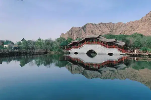
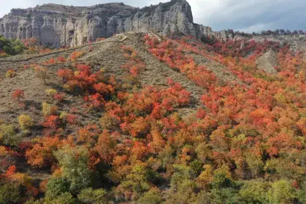
Notable sites include the Rawak Buddhist Temple Ruins (a Gandharan-influenced stupa complex in Lop County, designated a national key cultural heritage site in 2001), the Wuluwati Scenic Area (AAA-rated), Kunlun Lake Park (the largest park in Hotan at 88,000 m²), and the Yurungkash (White Jade) River—famous for yielding Hotan white jade across 36 jade varieties. The prefecture hosts six 4A/5A-level scenic areas and thirty 3A-and-below scenic areas. The prefecture also has 253 immovable cultural heritage sites (12 national-level), 348 intangible cultural heritage items (8 national-level), and 14,402 movable cultural artifacts.
Travel information can change. Check current opening hours, reservations and entry requirements before you travel.


Traveller discussion
Start the conversation with a helpful tip or a question.