
Xingtai City
Xingtai CityXingtai, abbreviated as "Xing" and historically known as Xingzhou and Shunde Prefecture, is a prefecture-level city under Hebei Province, classified as a Type II large city. It is an important national base for advanced equipmen
Xingtai City
Xingtai, abbreviated as "Xing" and historically known as Xingzhou and Shunde Prefecture, is a prefecture-level city under Hebei Province, classified as a Type II large city. It is an important national base for advanced equipment manufacturing, new energy, and health food industries, a famous historical and cultural city, a modern key node city linking the Beijing-Tianjin-Hebei region with the Central Plains, and an ecologically livable Taihang Spring City. It is also an important node city of the Shijiazhuang metropolitan area. As of the end of 2024, the city administers 4 districts, 12 counties, and 2 county-level cities, with a total area of 12,400 square kilometers and a permanent resident population of 6,877,800. Located in the southern part of Hebei Province, at the eastern foot of the southern section of the Taihang Mountains and the western edge of the North China Plain, Xingtai faces Shandong Province across the Wei-Yunhe Canal to the east, borders Shanxi Province along the Taihang Mountains to the west, connects with Handan City to the south, and borders Shijiazhuang City and Hengshui City to the north and northeast. Xingtai has over 3,500 years of urban history and over 800 years as a capital. Human habitation dates back 50,000 to 100,000 years. It was the first city in the history of North China and one of the earliest ancient capitals of China. The Shang Dynasty king Zu Yi's relocation of the capital to Xing marked the beginning of Xingtai's urban history, and the state officially designated the "Xing Ruins Site" as a Shang Dynasty capital. Xingtai is known as the "Capital of Five Dynasties and Strong Garrison of Ten Dynasties," with over 3,000 years of uninterrupted administrative establishment and no relocation of the city site. The ancient city of Xingtai is the earliest "first ancient city" built north of the Yellow River, known as "the First City of Yan-Zhao." With countless springs surfacing on flat ground, it has the reputation of "Taihang Spring City, Beautiful Xingtai." Its long history produced sages such as Guo Shoujing, Li Mu, Song Jing, and Liu Bingzhong, and emperors such as Guo Wei, Chai Rong, Meng Zhixiang, and Meng Chang. The First Emperor, Qin Shi Huang, died at Shaqiu in Xingtai during his eastern inspection tour. Xingtai is also the ancestral home of the Tang imperial family (the Tang Imperial Mausoleum). Events that shaped Chinese history, such as the abdication of Yao to Shun, the adoption of nomadic cavalry tactics, the Battle of Julu, and the Yellow Turban Rebellion, occurred here. Nearly a hundred idioms and allusions, including "break the cauldrons and sink the boats" (resolute determination), "who shall claim the deer" (uncertain victory), "fat and grease of the people" (people's livelihood), and "attacked from front and rear," originated in Xingtai. In 2024, Xingtai achieved a GDP of 276.59 billion yuan.
History
"Xing" is the most ancient place name of Xingtai, recorded in oracle bone inscriptions, where it was called "Jing" (Well). In the 17th century BCE, the Jiang-surnamed Jing tribe from the west migrated eastward along the river to southern Hebei, naming the place after their tribe as "Jing." The land of Xing had fertile soil and abundant water, with hundreds of springs competing to flow, hence the name "Jingfang" (Well Region).
The Yellow Emperor once personally farmed at Gan'yan Ridge in Xingtai. The "Book of Songs, Airs of the States" records: "Going out to lodge at Gan, drinking farewell at Yan." He personally led the Xing people to develop and utilize well water, establishing the well-field system, historically known as "The Yellow Emperor dug wells and gathered people to form a settlement." Later generations of the Xing people, to commemorate the Yellow Emperor's virtue of digging wells and building settlements, combined the characters for "well" and "settlement" into one character, which is the origin of the character "Xing." The Yellow Emperor's tribe and Chiyou's tribe fought nine battles at the Dalu Marsh in Xingtai, making it an important region for the fusion of the Huaxia (proto-Chinese) people. Emperor Yao in his later years established his capital at Bairen City in Xingtai and abdicated to Emperor Shun at Dalu, which is the origin of China's abdication system. Yu the Great controlled floods at the Dalu Marsh in Xingtai. The "Records of the Grand Historian" records: "Going north past the Feng River, arriving at Dalu (the Dalu Marsh)."
During the Xia Dynasty (c. 2070–1600 BCE), the "Tribute of Yu" designated the Nine Provinces, with Xing belonging to Jizhou. The lower component "gong" in the character "Ji" was originally the ancient character for "Xing," representing the Xing territory. Relics of ancient Chinese ancestors, such as Gun's Dike, Danzhu's Tomb, Mount Yao, Yao's Platform, Xiang City, Bairen City, and Gan'yan Ridge, still exist today.
In the 15th century BCE, the Shang Dynasty king Zu Yi moved the capital to Xing, making it the royal domain. This lasted for over a century through the reigns of kings Zu Xin, Wo Jia, and Zu Ding. At the end of the Shang Dynasty, the Marquis of Xing was one of the Three Dukes of the Shang court. King Di Xin (i.e., King Zhou of Shang) built a palace at Shaqiu in Xingtai, with pools of wine and forests of meat, drinking through the night. The Marquis of Xing, unable to bear the king's reckless behavior, indignantly remonstrated and was killed by the king. The "Imperial Annals" states: "The Marquis of Xing was one of King Zhou's Three Dukes and was executed for loyal remonstration."
In 1060 BCE, King Cheng of Zhou enfeoffed Ji Ju, the fourth son of the Duke of Zhou, as Marquis of Xing, built Xing City, established the State of Xing, and governed the Xing territory for over four hundred years. In the seventeenth year of King Xiang of Zhou (635 BCE), the State of Wei used a strategy of sowing discord to destroy Xing. The Han bamboo-slip version of "The Art of War" records: "When Wei rose, the Wei army was adjacent to Xing." In the twenty-first year of King Xiang of Zhou (631 BCE), Duke Wen of Jin attacked Wei, and the State of Xing came under Jin. In the sixteenth year of King Zhending of Zhou (453 BCE), Xing came under the State of Zhao. The son of the King of Zhao, Zhao Xiangzi, once held Xing as his fief, hence the name "Xiangguo" (the origin of the term "Xing-Xiang Land"). In the fourth year of King Lie of Zhou (372 BCE), Marquis Cheng of Zhao occupied Xing, and it became the Xindu (Faith Capital) of the State of Zhao. In the twentieth year of King Wuling of Zhao (307 BCE), the State of Zhao held a grand court session at the Xin Palace for five days, issuing the national policy of adopting nomadic dress and cavalry tactics. In the fourth year of King Huiwen of Zhao (295 BCE), the Shaqiu Palace Incident occurred, and King Wuling of Zhao died at the Shaqiu Palace in Xingtai.
After Qin Shi Huang unified the six states, he abolished the enfeoffment system and established commanderies and counties. Xindu County was established at Xing, belonging to Julu Commandery, one of the thirty-six commanderies nationwide. In 210 BCE, Qin Shi Huang died at the Shaqiu Palace in Xingtai, and Hu Hai forged an imperial edict here to usurp the throne. In the first year of the Han Founding Emperor (206 BCE), Xiang Yu enfeoffed Zhang Er as King of Changshan, administering Xindu, renaming it Xiangguo, as the capital of the Changshan Kingdom.
In the fourth year of the Han Founding Emperor (203 BCE), Xiangguo County was established, belonging to the State of Zhao. In the first year of the Jianwu reign of the Eastern Han Dynasty (25 CE), Liu Xiu proclaimed himself emperor at Haocheng (present-day Baixiang), establishing the Eastern Han Dynasty. In the first year of the Zhongping reign of the Eastern Han (184 CE), Zhang Jiao of Julu Commandery launched the Yellow Turban Rebellion, ultimately leading to the formation of the Three Kingdoms. In the seventeenth year of the Jian'an reign of the Eastern Han (212 CE), the area was transferred to the Wei Commandery of Jizhou. During the Three Kingdoms period, it was still called Xiangguo County, belonging to the State of Wei under the Guangping Commandery of Jizhou.
In the sixth year of the Yongjia reign of the Western Jin Dynasty (312 CE), the Jie tribe leader Shi Le adopted Zhang Bin's strategy and seized Xiangguo. In the second year of the Daxing reign of the Eastern Jin Dynasty (319 CE), Shi Le proclaimed himself King of Zhao at Xiangguo, with the state name "Zhao" and capital at Xiangguo (present-day Xiangdu District), historically known as the Later Zhao.
During the Southern and Northern Dynasties (420–589), Xiangguo successively belonged to Guangping Commandery, Yiyang Commandery, and Nanhe Commandery. During the Northern Qi (550–577) and Northern Zhou (557–581), Xiangguo Commandery was established.
In the third year of the Kaihuang reign of the Sui Dynasty (583), commanderies were abolished and prefectures established, with Xiangguo Commandery reverted to a county, once subordinate to Mingzhou. In the ninth year of Kaihuang (589), Xiangguo County was renamed Long'gang County. In the sixteenth year of Kaihuang (596), Xingzhou was established in the Xing territory. In the third year of the Daye reign (607), Xiangguo Commandery was re-established, administering Long'gang.
In the first year of the Wude reign of the Tang Dynasty (618), Xiangguo Commandery was changed to Xingzhou. In the first year of the Tianbao reign (742), Xingzhou was abolished and changed to Julu Commandery. In the second year of the Zhide reign (757), it reverted to Xingzhou, with Long'gang under its jurisdiction.
During the Five Dynasties period (907–960), the Later Liang, Later Tang, Later Jin, Later Han, and Later Zhou all maintained Xingzhou in the Xing territory, administering Long'gang County.
From the first year of the Jianlong reign to the first year of the Chonghe reign of the Song Dynasty (960–1118), Xingzhou was maintained. In the first year of the Xuanhe reign (1119), Xingzhou was abolished and Xinde Prefecture was established. In 1120 (the second year of Xuanhe), Emperor Huizong of Song combined the ancient character "Xing" with the "Tai" from the "Xingtai" (administrative platform) built by the Marquis of Xing, renaming Long'gang County to Xingtai County, subordinate to Xinde Prefecture. From this point, the name "Xingtai" originated. In the seventh year of Xuanhe (1125), Xing came under Jin territory. In the seventh year of the Tianhui reign of the Jin Dynasty (1129), Xinde Prefecture was changed to Xingzhou, with Xingtai County as the seat of Xingzhou.
In the third year of the Zhongtong reign of the Yuan Dynasty (1262), Khubilai Khan established a marshal's office in Xingtai. In September of the same year, Xingzhou was changed to Shunde Prefecture. In the second year of the Zhiyuan reign (1265), Shunde Prefecture was changed to Shunde Circuit, subordinate to the Zhongshu Province.
In the first year of the Hongwu reign of the Ming Dynasty (1368), Shunde Circuit was changed to Shunde Prefecture, directly under the imperial capital. The Qing Dynasty (1644–1912) basically followed the Ming system, with the subordinate relationship unchanged.
In the second year of the Republic of China (1913), prefectures were abolished and counties retained. Xingtai's counties belonged to the Jinan Circuit of Zhili Province. In the third year of the Republic (1914), Jinan Circuit was renamed Daming Circuit. In the seventeenth year of the Republic (1928), Zhili Province was renamed Hebei Province, circuits were abolished, and all counties were directly under Hebei Province. In the twenty-fifth year of the Republic (1936), Hebei Province established the Fifteenth District Administrative Inspection Office in Xingtai. In the twenty-sixth year of the Republic (1937), on October 15, Japanese forces occupied Xingtai and established the puppet Shunde Circuit. Concurrently, the Chinese Communist Party carried out anti-Japanese salvation movements, penetrating behind enemy lines in North China to establish the Shanxi-Hebei-Shandong-Henan Border Region anti-Japanese government. In August 1938, the Jinan Administrative Director's Office was established at Nangong in Xingtai. In August 1945, Japan announced unconditional surrender; on September 24, Xingtai was liberated; on September 25, the urban area of Xingtai County was separated to establish Xingtai City, and the Xingtai Municipal Government was proclaimed, marking the beginning of Xingtai's city-level administration.
In September 1948, the North China People's Government was established, the Shanxi-Hebei-Shandong-Henan Border Region was abolished, and Xingtai's counties belonged to the North China Administrative Region. On August 1, 1949, the Hebei Provincial People's Government was established, and the Xingtai Special District was created from the former Fourth Sub-district of Jinan and some counties of the First Sub-district of Taihang in the North China Administrative Region. The Xingtai Administrative Inspection Commissioner's Office was also established, subordinate to the Hebei Provincial People's Government, with its seat at Xingtai City.
On November 1, 1949, Xingtai City was downgraded to Xingtai Town, subordinate to the Commissioner's Office. In April 1950, the Xingtai Administrative Inspection Commissioner's Office was renamed the Hebei Provincial People's Government Xingtai Commissioner's Office, administering Xingtai Town and 15 counties (Xingtai, Shahe, Neiqiu, Lincheng, Longyao, Renxian, Baixiang, Nanhe, Ningjin, Julu, Pingxiang, Xinhe, Guangzong, Nangong, Weixian), totaling 16 county/town people's governments. In 1953, Xingtai Town was elevated to Xingtai City (a province-administered city). In 1955, the city government was renamed the Xingtai Municipal People's Committee.
In April 1958, under the national policy of merging large counties and large communes, the provincial people's committee decided to abolish the Xingtai Commissioner's Office, merging it with the Handan Commissioner's Office, and transferring Ningjin County and Xinhe County to the Shijiazhuang Commissioner's Office. In July 1958, the Xingtai Commissioner's Office was formally merged into the Handan Commissioner's Office. In November 1958, 15 counties/cities were merged into 4 large counties. In May 1961, the Xingtai Special District was restored. By March 1962, the original 1 city and 16 county establishments had been successively restored. In December 1964, Linxi County was established. At this point, the Xingtai Commissioner's Office administered 1 city and 17 counties, totaling 18 county/city people's governments.
In November 1983, Xingtai City was elevated from a prefecture-administered city to a province-administered city, with the municipal government directly under the provincial government. In May 1986, with State Council approval, Xingtai County was placed under Xingtai City. On July 1, 1993, Xingtai Prefecture and Xingtai City were merged into Xingtai City, abolishing Xingtai Prefecture, establishing the new prefecture-level Xingtai City, implementing the city-administering-county system.
Administrative Divisions
Divisional History
In September 1948, the North China People's Government was established. In 1949, the Xingtai Special District was created. On November 1, 1949, Xingtai City was downgraded to Xingtai Town. In 1953, Xingtai Town was elevated back to a province-administered city. In 1958, the Xingtai Commissioner's Office was merged with Handan. In May 1961, the Xingtai Special District was restored. By March 1962, the original 1 city and 16 county establishments were restored. In December 1964, Linxi County was established.
In March 1980, with State Council approval, Xingtai City established Qiaodong District, Qiaoxi District, and Suburban District. In November 1983, Xingtai City was elevated to a province-administered city. In May 1986, Xingtai County was placed under Xingtai City's leadership. In March 1986 and May 1987, Nangong and Shahe counties were successively converted to county-level cities. In July 1993, Xingtai Prefecture and Xingtai City merged into the new prefecture-level Xingtai City.
In June 2020, the State Council approved the adjustment of Xingtai's administrative divisions: Qiaodong District was renamed Xiangdu District, Qiaoxi District was renamed Xindu District, Xingtai County was abolished with its territory split between Xiangdu and Xindu districts, Renxian County was abolished and established as Renze District, and Nanhe County was abolished and established as Nanhe District.
Division Details
As of 2022, Xingtai City administers 4 municipal districts (Xiangdu District, Xindu District, Renze District, and Nanhe District), 12 counties (Neiqiu County, Lincheng County, Longyao County, Baixiang County, Ningjin County, Julu County, Pingxiang County, Xinhe County, Guangzong County, Weixian County, Linxi County, and Qinghe County), and 2 county-level cities (Shahe City and Nangong City). It also has the Xingtai Economic Development Zone and the Hebei Xingtai High-tech Industrial Development Zone (Xingdong New Area). The Xingtai Municipal People's Government is located at No. 166 Xinxi Street, Xiangdu District, Xingtai City. There are 198 townships, towns, and sub-district offices.
Geographical Environment
Location and Boundaries
Xingtai City is located in the central-southern part of Hebei Province, at the eastern foot of the southern section of the Taihang Mountains and the central part of the North China Plain, at the center of Shanxi, Hebei, and Shandong provinces. Between 36°50′–37°47′N latitude and 113°52′–115°49′E longitude, it faces Shandong Province across the Grand Canal to the east, borders Shanxi Province along the Taihang Mountains to the west, connects with Shijiazhuang City and Hengshui City to the north and northeast, and borders Handan City to the south. The city extends 185 kilometers at its widest east-west point and 80 kilometers north-south, with a total area of 12,400 square kilometers.
Landforms
Xingtai is situated at the intersection of the eastern foot of the southern Taihang Mountains and the North China Plain, with dramatic elevation differences. The terrain descends from west to east in a stepped arrangement of mountains, hills, and plains, with plains predominating. The Beijing-Guangzhou railway runs north-south along the boundary between hills and plains. Mountainous areas are in the west, covering 1,767.31 square kilometers (14.21% of the total), with peaks mostly above 500 meters elevation. Peaks exceeding 1,000 meters include Beiwudang Mountain (1,437m), Huangyuling (1,386m), Yunmeng Mountain (1,384m), Zijin Mountain (1,370m), Xiwuzhi Mountain (1,352m), Dafotangnao (1,310.7m), Taiziyan (1,141m), and Lingxiao Mountain (1,129.6m). The highest peak is Bulaoging Mountain, with its main peak Shizigeliang at 1,822 meters. Plains are east of the Beijing-Guangzhou railway, covering 8,765.75 square kilometers (70.50% of the total), at 100–30 meters elevation, serving as Xingtai's "granary" and "cotton sea."
Climate
Xingtai has a warm temperate sub-humid monsoon climate with four distinct seasons, large annual temperature differences, and concentrated precipitation. The average annual temperature is 12°C–14°C, with January being the coldest month averaging -2°C (extreme low of -20°C), and July the hottest averaging 27°C (extreme high of 41°C). Spring brings dust storms and dry weather; summer is hot and rainy; autumn has stable, cool weather; and winter has little snow and is dry and cold.
Hydrology
The Ziya River basin has 15 flood channels: Xiao River, Beisha River, Wu River, Di River, Liyang River, Xiaoma River, Niuwei River, Baima River, Qili-Shunshui River, South Li River, Shamang River, Liulei River, North Li River, Fuyang River, and New Fuyang River. Except for Liulei River, all originate in the western Taihang Mountains, with numerous upstream sources and an inverted broom-shaped drainage pattern. The channels are wide upstream and narrow downstream, with short, rapid flows, little base flow, and sometimes even drying up. During flood season, floods form rapidly with strong destructive force. Eight channels (Liulei River, Shamang River, Qili-Shunshui River, Niuwei River, South Li River, Baima River, Xiaoma River, and Liyang River) converge at the Dalu Marsh, then flow into the North Li River. The North Li River, Di River, Wu River, Beisha River, and Xiao River flow into Ningjin Marsh, then at Aixinzhuang merge into the New Fuyang River, flowing into Hengshui City.
The Heilonggang area has 5 main drainage channels: Laozhang River, Fudongpai River, Xisha River, Suolu River, and Lao-Shaqing River, with 14 larger drainage tributaries and 52 general drainage tributaries.
The Wei-Yunhe Canal is the boundary river between Hebei and Shandong provinces, running 58 kilometers through Xingtai.
Soil
Based on the 1980–1984 citywide soil survey, Xingtai has 6 soil types, 16 subtypes, 46 soil genera, and 113 soil species: brown soil (266,718.9 mu, in western mountainous areas above 1,000m), cinnamon soil (2,567,507.6 mu, in western mountainous and hilly areas below 1,000m), fluvo-aquic soil (142,565 mu, in eastern low-lying areas), meadow soil (27,274 mu, in intermontane and river valleys), paddy soil (8,028.6 mu), and swamp soil (5,816 mu, in eastern low-lying areas).
Natural Disasters
Common natural disasters in Xingtai include floods, droughts, locusts, strong winds, hail, and earthquakes, with insect plagues often following droughts and epidemics following floods.
Flood-prone areas are mainly along the Niuwei River and Qili River in the eastern part of the city. The primary causes are: 1) frequent torrential rains (averaging 3.7 times annually, with a record of 12 in 1963); 2) low-lying areas with poor drainage. From August 2–4, 1963, continuous torrential rains caused an unprecedented catastrophic flood. On May 21, 1987, three townships with 37 villages were struck by extreme windstorms, with 100mm of rainfall in 90 minutes, damaging 2,426 mu of wheat with economic losses of 1.2 million yuan.
Xingtai is located on the Neocathaysian tectonic system and the Taihang mountain front fault zone, where earthquakes are frequent. On March 8, 1966, a magnitude 6.8 earthquake struck Longyao County, affecting Xingtai with intensity 4–5. On March 22, 1966, a magnitude 7.2 earthquake struck southeast of Ningjin, affecting Xingtai at intensity 6, collapsing 890 rooms, damaging 1,543, and cracking 14,322. On July 28, 1976, the magnitude 7.8 Tangshan earthquake affected Xingtai at intensity 4.8.
Natural Resources
Water Resources
Xingtai has 21 rivers, all belonging to the Ziya River and Heilonggang systems of the Hai River basin (except the eastern border Wei-Yunhe Canal), with a total channel length of 1,052 kilometers and 1,121 kilometers of dikes. There are 16 flood channels and 5 drainage channels. The Fuyang River flows north-south through the city, dividing the area into Fuxi and Heilonggang sections.
Land Resources
Xingtai's terrain descends from west to east, with western Taihang Mountains, central hills, and eastern North China Plain in a ratio of approximately 2:1:7. As of the end of 2015, the city has 694,044 hectares of arable land, 55,336 hectares of orchard land, 133,521 hectares of forest land, 79,076 hectares of grassland, 159,265 hectares of urban/mining land, 36,901 hectares of transportation land, 45,271 hectares of water and water conservancy land, and 39,913 hectares of other land. Xingtai is a traditionally major agricultural city, known as the "Cotton Sea and Granary."
Biological Resources
Xingtai's vegetation belongs to the Pan-Arctic floristic region, China-Japan sub-region, Hebei-Henan sub-province, Taihang Mountain floristic area—semi-arid forest shrub grass vegetation zone. Due to long-term cultivation and historical warfare, the original vegetation has been largely destroyed, with current vegetation being secondary and cultivated. The city has 126 families, over 600 genera, and over 1,230 species of plants, mainly including Chinese pine, hornbeam, Liaodong oak, Abelia, and hazel. There are approximately 300 species of terrestrial vertebrates and over 60 economically valuable aquatic species. The western Taihang Mountains have 187 species of wild terrestrial vertebrates.
As of the end of 2022, 42,600 hectares of afforestation were completed. The city has 1 provincial-level nature reserve—the Sancha Mountain Reserve, established in Lincheng County's western deep mountains, with a planned total area of 5,464.7 hectares (core area 1,798.0 hectares, buffer zone 1,540.2 hectares, experimental zone 2,126.5 hectares).
Mineral Resources
Xingtai has rich mineral resources with distinctive regional characteristics. Coal is mainly distributed in Shahe City, Xindu District, Xiangdu District, Neiqiu County, and Lincheng County; iron ore in Shahe City; rock salt in Ningjin County; building material minerals in the western Taihang Mountains; and geothermal resources widely distributed in the eastern plains. The city has discovered 46 types of minerals (2 fuel, 8 metallic, 34 non-metallic, 2 water-vapor). Coal, iron, rock salt, and kyanite hold important positions in the province. As of the end of 2017, proven reserves included 4.053 billion tonnes of coal, 348 million tonnes of iron ore, 253.85 billion tonnes of salt ore (219.74 billion tonnes NaCl equivalent), 1.004 billion tonnes of limestone for cement, and 2.3363 million tonnes of kyanite.
Population
As of the end of 2024, Xingtai's permanent resident population was 6,877,800. Of these, the urban permanent resident population was 3,921,700, with an urbanization rate of 57.02%, up 0.7 percentage points from the end of the previous year.
Politics
Economy
Overview
In 2024, Xingtai's private economy value added was 187.58 billion yuan, up 4.8%, accounting for 67.8% of GDP. The GDP was 276.59 billion yuan, up 4.5%. The primary industry value added was 34.79 billion yuan, up 2.5%; the secondary industry 99.63 billion yuan, up 2.7%; and the tertiary industry 142.17 billion yuan, up 6.4%. The three industries accounted for 12.6%, 36.0%, and 51.4% of GDP respectively. Per capita GDP was 39,989 yuan, up 5.6%.
In 2024, general public budget revenue was 21.696 billion yuan, up 1.2%, with tax revenue of 11.88 billion yuan, down 1%. General public budget expenditure was 68.56 billion yuan, up 6.9%. Fixed asset investment (excluding rural households) grew by 9.8%.
In 2024, new urban employment was 70,399, completing 104.76% of the annual plan. Reemployment of urban unemployed was 31,093, up 11,347. Per capita disposable income was 29,952 yuan, up 5.0%; urban residents' per capita disposable income was 40,007 yuan, up 4.2%; rural residents' was 19,725 yuan, up 6.0%. The urban-rural income ratio was 2.03, narrowing by 0.03.
Primary Industry
In 2024, grain sown area was 11.577 million mu, up 0.1%. Total grain output was 4.948 million tonnes, up 4.5%. Cotton output was 24,000 tonnes, down 28.6%. Vegetable and edible mushroom output was 3.204 million tonnes, up 1.6%. Garden fruit output was 1.080 million tonnes, up 1.4%. Edible nut output was 78,000 tonnes, up 2.8%. Major livestock meat output was 358,000 tonnes, down 2.7%, with pork at 211,000 tonnes (down 5.3%), beef at 33,000 tonnes (up 0.9%), mutton at 20,000 tonnes (down 2.4%), and poultry at 94,000 tonnes (up 2.2%). Egg output was 488,000 tonnes, up 4.6%; milk output was 436,000 tonnes, down 0.2%.
Secondary Industry
In 2024, total industrial value added was 85.96 billion yuan, up 3.2%. Value added of industrial enterprises above designated size grew by 2.5%. By ownership, state-controlled enterprise value added fell 8.7%; joint-stock enterprises grew 2.4%; and foreign, Hong Kong, Macao, and Taiwan-invested enterprises grew 5.2%. By sector, mining fell 16.8%; manufacturing grew 4.6%; and electricity, heat, gas, and water production and supply grew 10.0%. Industrial enterprises above designated size realized total profits of 8.58 billion yuan, down 17.0%.
In 2024, high-tech industry value added declined 7.9%, accounting for 20.9% of industrial enterprises above designated size. Non-fossil energy power generation was 4.23 billion kWh, down 4.5%. PM2.5 average concentration was 44 micrograms per cubic meter, down 2.2%; good air quality days numbered 232, up 21 days.
In 2024, construction industry value added was 14.04 billion yuan, up 0.5%. Qualified construction enterprises achieved total profits of 770 million yuan, up 6.4%.
Tertiary Industry
As of the end of 2024, Xingtai's financial institutions had domestic and foreign currency loan balances of 635.699 billion yuan, up 11.78%; and deposit balances of 834.939 billion yuan, up 9.97%. Inclusive micro and small loan balances were 141.223 billion yuan, up 33.588 billion yuan from the beginning of the year.
In 2024, the wholesale and retail industry value added was 25.03 billion yuan, up 7.4%; transportation, warehousing, and postal services 15.99 billion yuan, up 2.7%; accommodation and catering 2.75 billion yuan, up 3.5%; information transmission, software, and IT services 3.68 billion yuan, up 11.5%; financial industry 25.77 billion yuan, up 11.6%; and real estate 15.37 billion yuan, up 2.7%.
In 2024, total import and export value was 23.47 billion yuan, down 7.3%. Exports totaled 20.56 billion yuan, down 9.0%; imports 2.91 billion yuan, up 6.6%. Trade with Belt and Road countries totaled 12.89 billion yuan (54.9% of total). Actual foreign investment utilized was 69.41 million USD, up 5.2%.
In 2024, total retail sales of consumer goods were 115.49 billion yuan, up 5.2%. Express delivery volume was 1.205 billion parcels, up 34.21%; express delivery revenue was 5.392 billion yuan, up 27.99%. Total telecom business was 5.80 billion yuan, up 16.1%. Mobile phone subscribers reached 7.8847 million. Fixed internet broadband subscribers reached 2.8543 million, up 168,500. The city received 45.3994 million domestic tourist visits, up 20.76%, with total tourism spending of 54.915 billion yuan, up 23.3%.
In 2024, insurance premium income was 14.186 billion yuan, up 5.12%, with insurance claim payouts of 6.923 billion yuan, up 9.33%.
Transportation
In 2024, Xingtai's highway freight volume was 224 million tonnes, up 6.43%; highway passenger volume was 178,000, up 52.2%. Airport passenger throughput was 30,900 (statistics from July 18 to December 31, 2024).
Highways
Xingtai has 7 expressways forming a network: the Beijing-Hong Kong-Macao Expressway, Daguang Expressway, Qingyin Expressway, Taihang Mountain Expressway, Xingheng Expressway, Xingfen Expressway, and Xinglin Expressway, plus the planned Jingwu Expressway. National highways 106, 107, and 308, along with numerous provincial highways, densely cover the territory. The Xingfen and Xinglin expressways connect Shanxi and Shandong provinces, providing the most convenient cross-province route. The "Two Rings, Six Links, Eight Horizontals, and Twelve Verticals" highway framework forms Xingtai's "Grand Cross" transportation hub.
Railways
Xingtai has formed a triple-fork railway network, with four national trunk lines running north-south: the Beijing-Guangzhou Railway, Beijing-Jiujiang Railway, Beijing-Guangzhou High-Speed Railway, and the under-construction Beijing-Jiujiang High-Speed Railway. Stations include Xingtai Station, Xingtai East Station, Qinghecheng Station, and the planned Qinghe East Station. The Xinghuang and Xinghe railways run east-west, with Xingtai South Station and Julu Station. Railway passenger service can reach all provincial capitals except Xinjiang, Tibet, Qinghai, Hainan, and Taiwan.
Aviation
Xingtai Dalian Airport (IATA: XNT, ICAO: ZBXT), located at Airport Road, Dalian Town, Shahe City, 18 kilometers south of Xingtai city center, is a 4C-level military-civilian dual-use regional airport. Civil aviation operations first began on July 1, 1993, suspended in September 2002, and the renovation project for resuming civil operations began on July 7, 2020. The terminal covers 6,100 square meters, with 6 parking positions and a 2,600-meter-long, 60-meter-wide runway, capable of handling 450,000 annual passengers, 1,300 tonnes of cargo, and 6,082 aircraft movements. The city also has five county-level general aviation airports in Weixian, Baixiang, Pingxiang, Lincheng, and Ningjin.
Public Transit
As of 2022, Xingtai operates 174 urban-rural bus routes with 1,500 vehicles, covering over 51 million kilometers annually and serving 210 million passengers, covering all 170 townships. The rural transit route conversion rate reached 85%. In 2017, Xingtai was selected as one of the first batch of "Hebei Province Priority Public Transit Demonstration Cities." In August 2019, intercity bus routes from the urban area to all county towns were officially opened, making Xingtai the first city in Hebei to achieve citywide urban-rural transit integration.
Social Undertakings
Education
As of the end of 2024, Xingtai has 6 general higher education institutions, enrolling 27,600 students (up 11.29%), with 80,900 total enrollment (up 7.86%). There are 74,900 secondary vocational school students, 193,700 general high school students, 383,200 junior high school students, 712,300 primary school students, and 177,300 kindergarten children.
Science and Technology
As of the end of 2024, Xingtai has 98 technology innovation centers (engineering technology research centers) and 10 key laboratories. Technology contracts signed numbered 1,877, with a transaction value of 6.3 billion yuan, up 19.9%. New patent authorizations were 7,717, up 1.46%. Valid invention patents totaled 3,116, up 19.94%. The city has 195 inspection and testing institutions, 2 national-level and 9 provincial-level quality inspection centers, 1,179 enterprises with mandatory product certification, and 88 earthquake intensity reporting and early warning stations.
Culture and Sports
In 2024, Xingtai has 23 registered museums, 19 public libraries, and 19 cultural centers. The city hosted over 400 large-scale mass sports events, including the 2024 Xingtai Marathon and the First National Youth Dragon Boat Race. Athletes won 65 gold, 40 silver, and 52 bronze medals in provincial competitions. 22 standardized sports parks were built or upgraded, 43 village/community fitness equipment sets were renewed, and 33 multi-functional sports grounds and public gyms were built.
Healthcare
As of the end of 2024, Xingtai has 9,874 medical and health institutions, including 191 hospitals, 173 township health centers, 119 community health service centers (stations), 19 maternal and child health centers, and 19 disease prevention and control centers. Health technical personnel numbered 58,800, including 27,900 practicing physicians and assistant physicians and 24,300 registered nurses. Medical institutions have 46,900 beds, including 36,200 in hospitals and 8,700 in township health centers.
Social Security
As of the end of 2024, 1.3832 million people participated in urban employee basic pension insurance, up 129,100. Of these, 880,100 participated in enterprise employee basic pension insurance (including retirees), up 115,400. Unemployment insurance participants numbered 605,600, up 23,700. Work injury insurance participants numbered 890,400, up 36,900, including 494,200 migrant workers. The city has 301 residential civil affairs service institutions with 29,353 beds, 92 special-care service institutions, and 4,771 community elderly care service institutions and facilities.
Historical Culture
Idiom Culture
Xingtai has accumulated deep cultural significance throughout history, with nearly a hundred idioms and allusions originating here.
Historical Sites
Xingtai Ancient City, also known as Shunde Prefecture City, was historically located in present-day Xingtai urban area. It is the city's geographic origin point, known as "the First City South of the Capital."
Intangible Cultural Heritage
As of 2022, Xingtai has 14 national-level intangible cultural heritage items, 41 provincial-level items, and 53 municipal-level items.
Folk Customs
Local folk customs include: daughters not needing to pay New Year visits; millet dumplings as a wedding dish; "jieshou" meaning going to the latrine; the Huanghe and Shunde birth customs; every household digging wells to avert disasters; hanging paper slips on roof beams for Jiang Taigong; going to the southern outskirts for prosperity; offering printed paper money; calling cucumbers "hugua"; and the "second child" being more beloved than the "firstborn."
Name Origin
"Xing" was recorded in oracle bone inscriptions as "Jing" (Well). Ancient Xingtai had hundreds of springs flowing, and the Xing people dug wells and built settlements, later combining the characters for "well" and "settlement" into "Xing." The "Kangxi Dictionary" states: "A hole in the ground yielding water is called a well." Ancient Xingtai had hundreds of springs competing to flow, hence the name Jingfang (Well Region). The "Book of Changes" says: "A well is the place of virtue." In ancient times, the Yellow Emperor farmed at Gan'yan Ridge in Xingtai. The "Book of Songs, Airs of the States" records: "Going out to lodge at Gan, drinking farewell at Yan." The Yellow Emperor taught the people to develop and utilize well water, building settlements, historically known as "The Yellow Emperor dug wells and gathered people to form a settlement." Later generations combined "well" and "settlement" into "Xing." As a place name, "Xing" first appeared in the "Bamboo Annals": "In the ninth year of Zu Yi of Shang, the capital was destroyed at Geng, and moved to Xing."
"Tai" means a platform built of earth on four sides, rising to a certain height. The earliest platform in Xingtai was built by the Marquis of Xing. In the twentieth year of Marquis Cheng of Zhao (355 BCE), Zhao built the Sandalwood Platform (Tantai) and the Xin Palace at Xingtai, establishing it as the Faith Capital (Xindu). The "Records of the Grand Historian, House of Zhao" records: "In the twentieth year, Wei presented fine rafters, which were used to build the Sandalwood Platform." The "Taiping Huanyu Ji" records: "Marquis Cheng of Zhao built the Sandalwood Platform, with the Xin Palace, as Zhao's alternate capital, to hold court with the feudal lords, hence called Xindu." In the first month of the nineteenth year of King Wuling of Zhao, the State of Zhao held a grand court session at the Xin Palace in Xingtai for five days, issuing the national policy of adopting nomadic dress and cavalry tactics. The "Shunde Prefecture Gazetteer" records: "An earth-built platform terrace, adorned with flowers and trees, was historically a place of grand outings!" The misty rain of the Sandalwood Platform has been one of the twelve scenic views of Shunde Prefecture since ancient times.
As a place name, "Xing" first appeared in the "Bamboo Annals": "In the ninth year of Zu Yi of Shang, the capital was destroyed at Geng, and moved to Xing." The "Records of the Grand Historian" also records "Zu Yi of Shang moved to Xing." Zu Yi established the capital at Xing and built a city there, making it the first city in the Xingtai area recorded in historical documents. Throughout history, Xingtai has been known by various names including Xindu, Xiangguo, Xingzhou, and Long'gang.
During the Western Zhou Dynasty, King Cheng of Zhou enfeoffed the fourth son of the Duke of Zhou as "Marquis of Xing," establishing the State of Xing to govern the Xing territory. The Marquis of Xing built an administrative platform (xingtai) at Jiangshui Village in present-day Xindu District, from which the "Tai" in "Xingtai" derives. In the second year of the Xuanhe reign of the Northern Song (1120), Emperor Huizong took one character each from "Xingzhou" and "Xingtai," renaming Long'gang County to Xingtai County, subordinate to Xinde Prefecture, from which the name Xingtai originated.
During the Yuan Dynasty (1271–1368), Khubilai Khan experimented with governance in Xing, through policies of selecting the worthy, promoting the beneficial, abolishing the harmful, and encouraging agriculture, making Xingtai "a joyful and contented prefecture," historically known as "the Great Order of Xingzhou." Khubilai elevated Xing to Shunde Prefecture, directly under the Zhongshu Province.
Scenic Spots
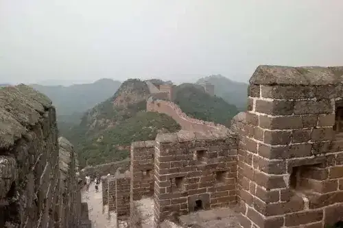
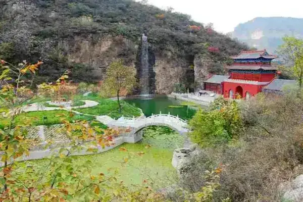
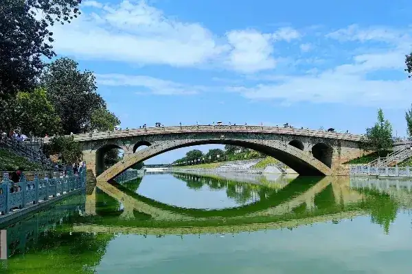
As of March 2025, Xingtai has 16 national AAAA-level tourist attractions, 54 national AAA-level tourist attractions, 1 national AA-level tourist attraction, 2 national-level scenic areas, 2 national geoparks, 2 national forest parks, 4 national water conservancy scenic areas, and 9 Chinese historical and cultural villages, forming four distinctive routes: mountain and water scenery tours, leisure agriculture tours, historical culture tours, and ancient village tours.
Local Specialties
"Xingzhou white porcelain is the finest under heaven." The Xing Kiln ranks first among the four great kilns of Hebei and is the birthplace of Chinese white porcelain. The invention and production of Xingzhou white porcelain broke the monopoly of celadon since the Shang Dynasty, creating the "south celadon, north white" pattern. The Tang Dynasty tea sage Lu Yu recorded that "Xing porcelain resembles silver and snow." Li Zhao of the Tang Dynasty said: "All under heaven, regardless of noble or humble, use it universally." The Tang poet Pi Rixiu described it as "round as a fallen moon soul, light as a rising cloud spirit." The Xing Kiln began firing in the late Northern Dynasties and reached its peak in the Tang Dynasty, becoming the earliest center of white porcelain production in China. The Xing Kiln occupies an extremely important position in the history of ancient Chinese ceramics, and the Xingzhou white porcelain kiln site has been listed as a national key cultural heritage protection unit, a national key great-site protection plan, and one of the top ten archaeological discoveries.
China is one of the earliest countries in the world to use iron, and Xingtai's iron smelting industry is also among the nation's earliest. Two thousand years ago, the people of Xingtai already knew that "where the mountain top has reddish soil, there is iron beneath." Xiangguo was one of the three major iron smelting bases under Emperor Wu of the Han Dynasty (141–87 BCE). The "Book of Sui, Treatise on Geography" and the "Yuanhe County Map Annals" record: "Shahe has Qingcheng Mountain, where the Han and Wei dynasties' old iron office was located." During the Northern Dynasties period, the Xingzhou metallurgy expert Qiwu Huaiwen invented the co-fusion steelmaking technique, the most advanced steelmaking method in the world before the 17th century. Tang Dynasty Xingzhou wrought-iron knives were premium tribute items. During the Northern Song Dynasty, Xingzhou was the nation's largest smelting center, with iron output ranking first nationwide during the Yuanfeng reign. Xingzhou iron smelting played an indispensable role in promoting the development and progress of Chinese history.
Famous Figures
External Exchange
Honorary Titles
Travel information can change. Check current opening hours, reservations and entry requirements before you travel.

Traveller discussion
Start the conversation with a helpful tip or a question.