
Place names and administrative divisions of Jiangsu Province
江苏省地名与行政区划
The name Jiangsu Province originates from the first characters of Jiangning Prefecture (present-day Nanjing) and Suzhou Prefecture (present-day Suzhou) during the Qing Dynasty. It is abbreviated as Su. Jiangsu, abbreviated as Su, is located on the eastern coast of mainland China, between 116°18′-121°57′ east longitude and 30°45′-35°20′ north latit…
The name Jiangsu Province originates from the first characters of Jiangning Prefecture (present-day Nanjing) and Suzhou Prefecture (present-day Suzhou) during the Qing Dynasty. It is abbreviated as Su.
Jiangsu Province, abbreviated as Su, is located on the eastern coast of mainland China, between 116°18′ and 121°57′ east longitude and 30°45′ and 35°20′ north latitude. It was established as a province in 1667 due to the division of the Jiangnan Provincial Administration Commission into eastern and western parts. The province's name is an abbreviation of the combined names of the former "Jiangnan Jianghuai Yangxu Haitong and other places' Administration Commission" and "Jiangnan Susong Changzhen Tai and other places' Administration Commission." Jiangsu borders the Yangtze River and the sea, controls the Huai River and lakes, and boasts a prosperous economy, advanced education, and flourishing culture. Spanning both north and south of the Yangtze and Huai Rivers, it possesses four major diverse cultural and regional characteristics: Wu, Jinling, Huaiyang, and Central Plains. Located in eastern China, Jiangsu geographically straddles north and south, and its climate and vegetation exhibit characteristics of both southern and northern regions. Jiangsu borders the Yellow Sea to the east and is adjacent to Shanghai, Zhejiang, Anhui, and Shandong provinces. The Yangtze River Delta urban agglomeration, formed by Jiangsu, Shanghai, and Zhejiang, has become one of the six major world-class urban agglomerations. Jiangsu ranks first among all provinces in China in terms of per capita GDP and Regional Development and Livelihood Index (DLI), and has reached the level of "upper-middle" developed countries.
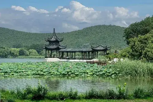
The province is characterized by flat terrain, vast plains, and a lack of towering mountains, but it boasts numerous famous mountains, large lakes, and a dense network of waterways connecting it to the sea. Except for the northern and southwestern edges, which are hilly and mountainous, the rest of the province comprises a vast plain formed by the Huang-Huai Plain, the Jiang-Huai Plain, the coastal plain, and the Yangtze River Delta. Plains cover 70,600 square kilometers, accounting for 69% of the total area; waterways cover 17,300 square kilometers, accounting for 16.9%; and hilly and mountainous areas cover 14,700 square kilometers, accounting for 14.3%. Yunu Peak, located in Yuntai Mountain on the outskirts of Lianyungang City, is the highest peak in the province, at 625 meters above sea level. Jiangsu Province ranks first among all provinces and regions in China in terms of the large area of plains, the high proportion of waterways, and the small area of low mountains, hills, and ridges, hence its nickname "Water Town Jiangsu."
Jiangsu Province has over 2,900 rivers and lakes, nearly 300 lakes, and more than 1,100 large, medium, and small reservoirs, ponds, and dams, making it the province (region) with the largest water area in China. Apart from the Yangtze and Huai Rivers, most of the province's rivers are small to medium-sized rivers with small drainage basins and relatively low flow rates. Based on waterway systems, the province's major rivers and lakes can be divided into three major systems: the Si-Yi-Shu River system, the Huai River system, and the Yangtze River and Taihu Lake system.
Travel information can change. Check current opening hours, reservations and entry requirements before you travel.
Traveller discussion
Start the conversation with a helpful tip or a question.