
Place names and administrative divisions of Tibet
西藏地名与行政区划
The origin of the name Tibet: During the Yuan and Ming dynasties, the Tibet region was called Ü-Tsang. "Ü" means "central" in Tibetan, and "Tsang" means "holy." Because it is located in western China, it was called Tibet. The Tibet Autonomous Region was established in 1965, abbreviated as Tibet. Tibet is located in the southwestern border region o…
Origin of the name Tibet: During the Yuan and Ming dynasties, the Tibetan region was called Ü-Tsang. "Ü" means "central" in Tibetan, and "Tsang" means "holy." Because it is located in western China, it was called Tibet. In 1965, the Tibet Autonomous Region was established, abbreviated as Tibet.
Tibet is located in the southwestern border region of China, covering an area of 1,202,200 square kilometers, ranking second among all provinces, autonomous regions, and municipalities in China. It lies between 78°24′ and 99°06′ east longitude and 26°52′ and 36°32′ north latitude. It borders Xinjiang Uygur Autonomous Region and Qinghai Province to the north, faces Sichuan Province across the Jinsha River to the east, is connected to Yunnan Province by mountains and rivers to the southeast, and borders India, Nepal, Bhutan, Myanmar, and the Kashmir region to the south and west. With a border line of over 4,000 kilometers, accounting for one-sixth of China's land border, Tibet is an important gateway and barrier for my country's southwestern frontier, holding a strategically vital position. The region has an average altitude of over 4,000 meters, a maximum north-south width of over 900 kilometers, and a maximum east-west length of over 2,000 kilometers. It is characterized by towering mountains, numerous rivers and lakes, high altitude, cold climate, low oxygen levels, sparse population, and abundant resources.
With an average altitude of over 4,000 meters, the region is the world's largest and highest plateau, often referred to as the "Roof of the World." It has a plateau climate, with significant differences between the southern Tibetan valleys and the northern Tibetan plateau. The southern Tibetan valleys are mild and rainy, with an average annual temperature of around 8 degrees Celsius; the northern Tibetan plateau has a continental climate, with an average annual temperature below 0 degrees Celsius and a freezing period lasting up to six months. The characteristics of Tibet's climate are low temperatures, low rainfall, thin air, and abundant sunshine.
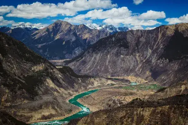
Within the Tibet Autonomous Region, there are more than 20 rivers with a drainage area exceeding 10,000 square kilometers, and over 100 rivers with a drainage area exceeding 2,000 square kilometers. Notable rivers include the Jinsha River, Nu River, Lancang River, and Yarlung Tsangpo River. Tibet also boasts the most internationally significant river network among Chinese provinces, with the upper reaches of many famous Asian rivers such as the Ganges, Indus, Brahmaputra, Mekong, Salween, and Irrawaddy. The water sources of Tibetan rivers primarily consist of rainwater, snowmelt, and groundwater, resulting in abundant flow, low sediment content, and good water quality.
The Yarlung Tsangpo River is the longest river in Tibet, originating from the Jiemayangzong Glacier in Zhongba County, Ngari Prefecture, on the northern slopes of the Himalayas. Within China, it stretches 2,057 kilometers, with a drainage area of over 240,000 square kilometers and an average elevation of approximately 4,500 meters, making it the highest-altitude major river in the world. After flowing into India, the Yarlung Tsangpo River is known as the Brahmaputra River.
The Tibetan Plateau has over 1,500 lakes of varying sizes, including Namtso, Silingco, and Zhaxiamuco, which have areas exceeding 1,000 square kilometers, and 47 lakes with areas exceeding 100 square kilometers. The total area of these lakes is approximately 24,000 square kilometers, accounting for about one-third of the total lake area in China. The Tibetan Plateau is not only China's largest lake-dense region but also the world's highest, largest, and most numerous plateau lake region. Most of these lakes are saltwater, with fewer freshwater lakes, and 17 of them have an elevation exceeding 5,000 meters.
Travel information can change. Check current opening hours, reservations and entry requirements before you travel.
Traveller discussion
Start the conversation with a helpful tip or a question.