
[Xinjiang Map] 2027 Xinjiang Tourist Attractions Map & North and South Xinjiang Tourist Map (High-Resolution Version)
[Xinjiang Map] 2027 Xinjiang Tourist Attractions Map & North and South Xinjiang Tourist Map (High-Resolution Version) Author: Isla | Updated: August 14, 2025 A comprehensive collection of Xinjiang maps is here! It includes maps of tourist attractions throughout Xinjiang, as well as maps of tourist attractions in Urumqi, Kashgar, and other areas. I…
[Xinjiang Map] 2027 Xinjiang Tourist Attractions Map & North and South Xinjiang Tourist Map (High-Resolution Version)
Author: Isla | Updated: August 14, 2025
Do you yearn for the magnificent scenery of Xinjiang, but feel overwhelmed by its vast territory and complex routes? This Xinjiang map guide will be your invaluable assistant, helping you understand the distribution of popular attractions, transportation networks, and the best itinerary combinations, allowing you to easily explore Xinjiang and not miss any of its stunning landscapes and unique experiences!
I. Map of Xinjiang Tourist Attractions
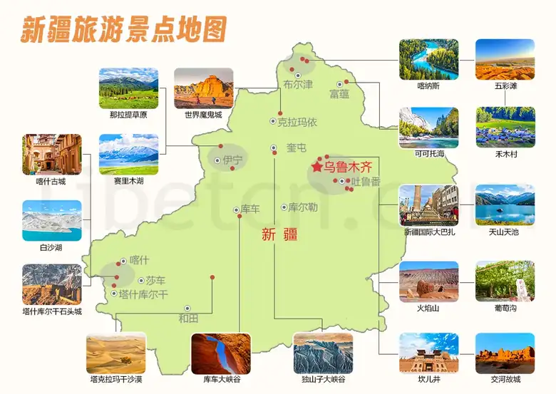
Xinjiang, located in Northwest China and bordering Russia and several other countries, is one of the most popular tourist destinations in China. This magical land of Xinjiang hides countless breathtaking landscapes: vast deserts, majestic snow-capped mountains, crystal-clear alpine lakes, and ancient villages brimming with ethnic charm… However, given the vastness of Xinjiang, pinpointing your desired attractions can be challenging. But the Xinjiang tourist map below clearly shows that popular tourist spots are generally concentrated in several distinctive areas. Following this map will make planning the best Xinjiang travel itinerary much easier.
Xinjiang tourist attraction map
1. Northern Xinjiang region: Urumqi, Yining, Kuitun, Karamay, Fuyun, Burqin
Kanas:Hidden deep in the Altai Mountains, this secret place is known as "God's back garden." Its lakes change colors with the seasons, but are most beautiful in autumn when the forests are ablaze with color, like a palette spilled by God.
Tianchi Lake in Tianshan Mountains:Surrounded by snow-capped mountains, this alpine lake is said to be the Jade Pool of the Queen Mother of the West. Its waters are as blue as gemstones, reflecting the beautiful scenery of the snow-capped mountains.
Boat trip to Tianchi Lake in Tianshan
World Devil City:The Yardang landforms are spectacular; when the wind howls, they sound like ghosts wailing and wolves howling. At sunset, the "castles" under the golden afterglow are the most magnificent.
Hemu Village:The Tuvan people's original villages are known as "China's most beautiful ancient villages". In autumn, the golden birch forests and blue sky and white clouds complement each other, making them as beautiful as an oil painting.
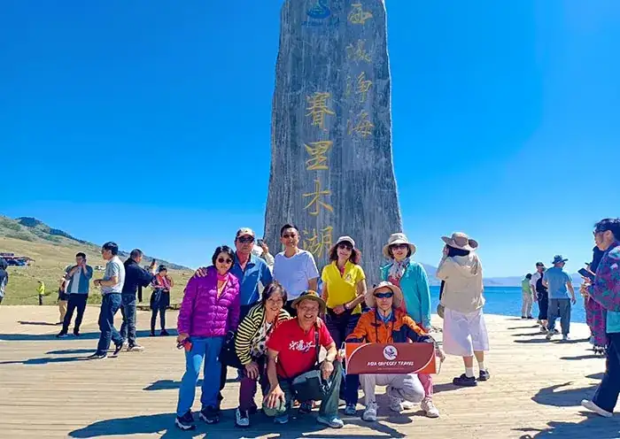
Northern Xinjiang Mini-Loop | 8-Day, 7-Night Essential Tour of Urumqi, Tianchi Lake, Kanas, Hemu, and Sayram Lake
Urumqi-Fuyun-Kanas-Hemu-Burqin-Kuitun-Yining-Urumqi
Wucaitan (Five-Colored Beach):The colorful calcified pools reflect dreamlike colors under the sunlight, like an overturned palette scattered on earth.
Koktokay:The blue wonderland in the canyon, with the Ertis River flowing through it, and the mountainsides ablaze with autumn colors, is breathtakingly beautiful. The No. 3 mine, viewed from above, resembles the rings of the earth.
Sayram Lake:One of the most beautiful places in Xinjiang, it is known as "the last tear of the Atlantic Ocean".
Narat Grassland:One of China's most beautiful grasslands, where you can ride horses and experience the purest grassland life.
Xinjiang International Grand Bazaar:The largest market in Central Asia, full of exotic charm, is the best place to experience authentic Xinjiang life.
Dushanzi Grand Canyon:The geological wonders carved out by the snowmelt from the Tianshan Mountains are most breathtaking when viewed from the air.
2. Southern Xinjiang region: Kashgar, Shache, Tashkurgan, Hotan, Kuqa, Korla
Taklamakan Desert:Crossing the desert highway through China's largest desert is an unforgettable experience, allowing you to fully appreciate the magnificence and desolation of the "Sea of Death."
Kashgar Old City:This living ancient city, with its labyrinthine streets and alleys and century-old teahouses, is a great place to experience Uyghur life.
Baisha Lake:The Pamir Plateau's sapphire-like landscape features white sand dunes reflected in the lake, where the water changes color with the light, creating a stunning effect.
Tashkurgan Stone City:One of China's three major stone cities, it is an excellent place to learn about the ancient Silk Road.
Kuqa Grand Canyon:One of China's most beautiful Danxia canyons, its reddish-brown rocks are particularly enchanting under the sunlight.
South to North | Classic 7-Day, 6-Night Group Tour from Kashgar to Urumqi, Xinjiang
Kashgar-Tashkurgan-Kashgar-Urumqi-Tianchi-Urumqi-Turpan-Urumqi
3. Eastern Xinjiang region: Turpan
Flaming Mountain:It is famous for being associated with the classic novel "Journey to the West" and is known as "China's hottest place". Its mountains are fiery red and its landforms are unique.
Flaming Mountain Grand Canyon
Karez wells:An ancient Chinese water conservancy project on par with the Great Wall and the Grand Canal, its underground channels nourish the Turpan oasis.
Jiaohe Ancient City:The world's largest and oldest earthen city, its ruins still allow us to imagine the prosperity of the Silk Road in its heyday.
Grape Valley:The green corridor at the foot of Flaming Mountain boasts some of the world's sweetest grapes, and August is the best time to enjoy them.
For detailed travel guides to Xinjiang tourist attractions, please refer to:Top 10 Must-Visit Attractions in Xinjiang
II. Map of tourist attractions in Urumqi, Xinjiang
Urumqi, located in central Xinjiang, China, is the capital city of Xinjiang and a vital transportation hub connecting attractions throughout the region. You can use the tourist map of Urumqi below, which marks the attractions, airport, and train station, to plan your itinerary.
Map of tourist attractions in Urumqi, Xinjiang
1. What are some fun places to visit in Urumqi?
If you have a short stay in Urumqi, you can visit the Xinjiang Museum to learn more about the history and culture of Xinjiang and the ancient Silk Road; you can also stroll around the Xinjiang International Grand Bazaar to buy Uyghur clothing, carpets, spices, ornaments, dried fruits and other specialties, and taste local delicacies such as fruits, hand-pulled rice, and mutton; or you can go to Hongshan Park to enjoy a stunning panoramic view of Urumqi.
In addition, you can visit Tianchi Lake and Nanshan Pasture, which are relatively close to Urumqi, and enjoy the breathtaking natural scenery.
2. Urumqi Transportation Guide
Urumqi Tianshan International Airport → City Center:It's about 19 kilometers away, a 30-minute drive. You can take Metro Line 1 to the city center.
Urumqi Station → City Center:It's about 9.2 kilometers away, and the journey takes about 18 minutes. You can take bus route 59 to the city center.
Urumqi South Railway Station → City Center:It's about 11 kilometers, and the journey takes about 20 minutes. You can take bus route 537 to the city center.
III. Map of tourist attractions in Kashgar, Xinjiang
Kashgar, located in southwestern Xinjiang, China, is one of the most exotic cities in Xinjiang, and it's said that "you haven't been to Xinjiang if you haven't been to Kashgar." Kashgar Old City is the top choice for visitors, where you can travel back in time with the opening ceremony and immerse yourself in the rich Western Region atmosphere. After visiting Kashgar Old City, you can continue your journey along the G314 (Kinshasa-Pakistan Friendship Highway), following the map of Kashgar's tourist attractions. Visit picturesque scenic spots like the White Sand Lake and the ever-changing Karakul Lake. Finally, arrive in Tashkurgan Tajik Autonomous County, where you can explore the breathtaking Tashkurgan Stone City and the lush Alar Golden Grassland, enjoying both natural beauty and cultural heritage.
Map of tourist attractions in Kashgar, Xinjiang
IV. Xinjiang Tourist Map
1. Northern Xinjiang Tourist Map
This route is a classic itinerary for traveling in Northern Xinjiang. In just 7 days, it will take you to explore the most beautiful scenery in Northern Xinjiang, and visit the essential attractions such as Tianchi Lake in the Tianshan Mountains, Hemu Village, Kanas, Wucaitan (Five-Colored Beach), and Karamay World Devil City. It is perfect for tourists visiting Xinjiang for the first time.
Xinjiang Northern Xinjiang Tourist Map
Northern Xinjiang Scenery | 7-Day Tour of Xinjiang's Urumqi, Tianchi Lake, Hemu Village, Kanas, Burqin, and Karamay's World Devil City Highlights
Xinjiang Urumqi - Tianchi Lake - S21 Desert Highway - Beitun - Hemu Village - Kanas - Jiadengyu - Burqin - Wucaitan - Urho - Karamay World Devil City - Urumqi
2. Southern Xinjiang Tourist Map
This is a popular itinerary for tourism in southern Xinjiang. It takes 8 days to take you to enjoy the natural and cultural beauty of Urumqi, Turpan, Kashgar and Tashkurgan in Xinjiang, and to see the most classic scenic spots, such as Tianchi Lake in the Tianshan Mountains, Jiaohe Ancient City, Karez Well, Kashgar Old City and Stone City, and to experience the most authentic Western Regions culture.
Xinjiang Southern Xinjiang Tourist Map
Western Regions Charm | 8-Day Nature and Culture Tour of Urumqi, Tianchi Lake, Jiaohe Ancient City, Karez Well, Kashgar Old City, Baisha Lake, and Stone City in Xinjiang
Xinjiang Urumqi - Tianchi Lake - Xinjiang Museum - Turpan - Flaming Mountains (by car) - Tuyugou (Mazar Village) - Bezeklik Thousand Buddha Caves - Jiaohe Ancient City Ruins - Karez Well - Sugong Pagoda (also known as Emin Pagoda) - Kashgar Old City - Karakoram Highway - Baisha Lake - Karakul Lake (also known as Karakul Lake) - Tashkurgan Stone City - Alar Golden Grassland - Kashgar
3. Urumqi Tourist Map
This itinerary is the essence of Urumqi tourism, requiring only 5 days. It will take you to visit the most essential attractions in Xinjiang, such as Tianchi Lake in the Tianshan Mountains, the Flaming Mountains, Jiaohe Ancient City, Karez Wells, Bezeklik Thousand Buddha Caves, Sugong Pagoda, etc., allowing you to appreciate the most charming natural and cultural landscapes of Xinjiang.
Urumqi, Xinjiang tourist map
First Impression of Xinjiang | A 5-Day Historical and Cultural Tour of Urumqi, Tianchi Lake, Xinjiang Museum, Turpan, Thousand Buddha Caves, Jiaohe Ancient City, and Karez Wells
Xinjiang Urumqi - Tianchi Lake (Heavenly Lake) - Xinjiang Museum - Turpan - Flaming Mountains (by car) - Tuyugou (Mazar Village) - Bezeklik Thousand Buddha Caves - Jiaohe Ancient City Ruins - Karez Wells - Sugong Pagoda (also known as Emin Pagoda) - Urumqi
4. Kashgar Tourist Map
This is a popular itinerary for tourists visiting Kashgar. It takes 5 days and will take you on an in-depth tour of the old city of Kashgar. Along the Karakoram Highway (G314), you will enjoy the scenery of the Pamir Plateau and the legacy of the ancient Silk Road, and experience the most authentic Western Region culture in Tashkurgan.
Kashgar, Xinjiang tourist map
Southern Xinjiang's Hidden Gems | 5-Day In-Depth Tour of Kashgar Old City, White Sand Lake, Karakul Lake, Tashkurgan Stone City, and Alar Golden Grassland
Xinjiang Kashgar - Kashgar Old City - Karakoram Highway - White Sand Lake - Karakul Lake (also known as Karakul Lake) - Tashkurgan Stone City - Alar Golden Grassland - Kashgar
V. Xinjiang Tourist Transportation Map
1. Xinjiang Airport Map
Xinjiang has a total of 28 airports, ranking first in China in terms of the number of airports. Among them, Urumqi Tianshan International Airport and Kashgar Laining International Airport are the most frequently used and important airports, and also have the most routes. You can choose your best route based on the airport locations marked on the Xinjiang airport map below.
Xinjiang Airport Map
Urumqi Tianshan International Airport (URC):Formerly known as Urumqi Diwopu International Airport, it is Xinjiang's main airport and the preferred airport for travel to northern Xinjiang. Domestically, major cities such as Beijing, Shanghai, and Chengdu offer direct flights to Urumqi, and internationally, neighboring cities in Russia and Kazakhstan also have direct routes to Urumqi. Furthermore, the airport boasts convenient transportation, making it easy to reach both downtown Urumqi and popular tourist attractions like Tianchi Lake in the Tianshan Mountains.
Kashgar Laining International Airport (KHG):Kashgar is the top choice for tourists visiting southern Xinjiang, with direct flights available from major domestic cities such as Beijing, Shanghai, and Chengdu. Furthermore, the airport is surrounded by convenient bus routes, airport express lines, and sightseeing shuttle buses, making travel easy.
If you want to go to Kanas, you can choose Burqin Kanas Airport; if you want to go to Turpan, you can choose Turpan Jiaohe Airport... Choose the best airport according to your destination.
2. Map of Xinjiang Railway Stations
Xinjiang boasts numerous railway stations, providing easy access to various parts of the region and making travel convenient. Urumqi Station is the terminus of the Lanzhou-Xinjiang High-Speed Railway, connecting Gansu and Xinjiang; Yining Station primarily serves Yili in northern Xinjiang and the Khorgos border crossing; while Kashgar Station, Turpan Station, and Kuqa Station belong to the main line of the Southern Xinjiang Railway. The relationships between these stations are clearly illustrated in the Xinjiang railway map below.
Xinjiang Railway Station Map
3. Transportation map from Urumqi to Kanas Lake
Both Urumqi and Kanas have airports; flying there takes approximately 3.5 hours. Alternatively, you can drive. The route via Karamay is about 750 kilometers and takes about 9.5 hours, offering breathtaking Yardang landforms along the way. The route via Beitun is about 650 kilometers and takes about 9 hours, with stunning Gobi oasis landscapes along the way. The route via Fuyun is about 800 kilometers and takes about 10 hours, with awe-inspiring golden mineral veins along the route. Finally, arrive at Kanas Lake and enjoy its ethereal beauty.
Urumqi to Kanas Lake transportation map
4. Transportation map from Urumqi to Kashgar
Although both Urumqi and Kashgar are located in Xinjiang, they are 1,500 kilometers apart, making the journey quite long. Air travel is the most popular mode of transportation, taking only about 2 hours. Train travel, on the other hand, offers excellent value, taking approximately 12-28 hours. If you wish to fully enjoy the natural and cultural scenery of Urumqi and Kashgar, you can choose to drive, which takes about 24 hours.
Urumqi to Kashgar transportation map
5. Transportation map from Urumqi to Turpan
Urumqi and Turpan are 200 kilometers apart, making the train the preferred mode of transportation, taking only about an hour. If you have more time and wish to leisurely enjoy the scenery along the route from Urumqi to Turpan, you can drive, which takes only 2.5 hours.
Urumqi to Turpan transportation map
6. Transportation map from Kashgar to Tashkurgan
Kashgar and Tashkurgan are both located in southern Xinjiang, about 300 kilometers apart. Both are close enough that air travel is the preferred mode of transportation, taking only 2 hours. If you wish to fully experience the captivating charm of southern Xinjiang, you can also choose to drive, which takes approximately 5.5 hours.
Kashgar to Tashkurgan transportation map
7. Transportation map from Urumqi to Beijing
Urumqi and Beijing are 2,800 kilometers apart, making air travel the preferred and most popular mode of transportation, with a flight time of approximately 4 hours. Train travel, on the other hand, is a more economical option, taking about 30.5 hours. If you have a longer vacation and enjoy the freedom of travel, you can also drive, which takes approximately 3 days.
Urumqi to Beijing transportation map
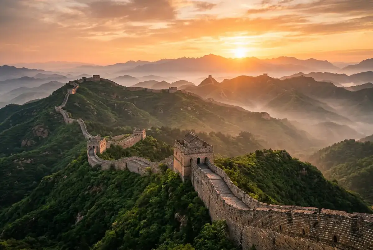
Recommended attractions in Beijing:The Forbidden City, the Great Wall (Badaling, Mutianyu, Jinshanling, and Simatai sections), the Summer Palace, the Yonghe Temple, Tiananmen Square, the Temple of Heaven, and Beijing's hutongs.For detailed Beijing tourist attraction guides, please refer to:13 Must-Visit Attractions in Beijing
Recommended classic itineraries in Beijing:
Explore Beijing | A Classic 4-Day Tour of Beijing, the Forbidden City, the Summer Palace, the Mutianyu Great Wall, and the Temple of Heaven
Beijing - Tiananmen Square - Forbidden City - Summer Palace - Mutianyu Great Wall - Bird's Nest and Water Cube - Temple of Heaven - Beijing
Beijing Panorama | 5-Day In-Depth Tour of Beijing + Forbidden City + Summer Palace + Mutianyu Great Wall + Temple of Heaven + Olympic Park + Museums
Beijing - Tiananmen Square - Forbidden City - Summer Palace - Mutianyu Great Wall - Olympic Park - Temple of Heaven - Imperial College - Hutongs - Beijing
Travel Through Time | 8 Days 7 Nights All-Inclusive Tour of Beijing + Xi'an + Shanghai
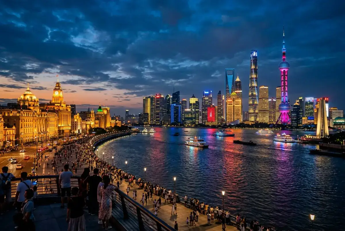
Beijing (Tiananmen Square + Forbidden City + Hutongs + Traditional Culture Experience + Beginner Tai Chi Course + Temple of Heaven + Mutianyu Great Wall) - Xi'an (Ancient City Wall + Muslim Quarter + Terracotta Warriors + DIY Mini Terracotta Warriors + Da Ci'en Temple + Big Wild Goose Pagoda + Hanfu Experience) - Shanghai (Shanghai Tower + High-Tech Robot Experience + Yu Garden & Yu Garden Mall + The Bund)
Photo gallery
Travel information can change. Check current opening hours, reservations and entry requirements before you travel.


Traveller discussion
Start the conversation with a helpful tip or a question.